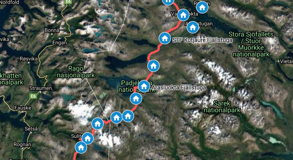
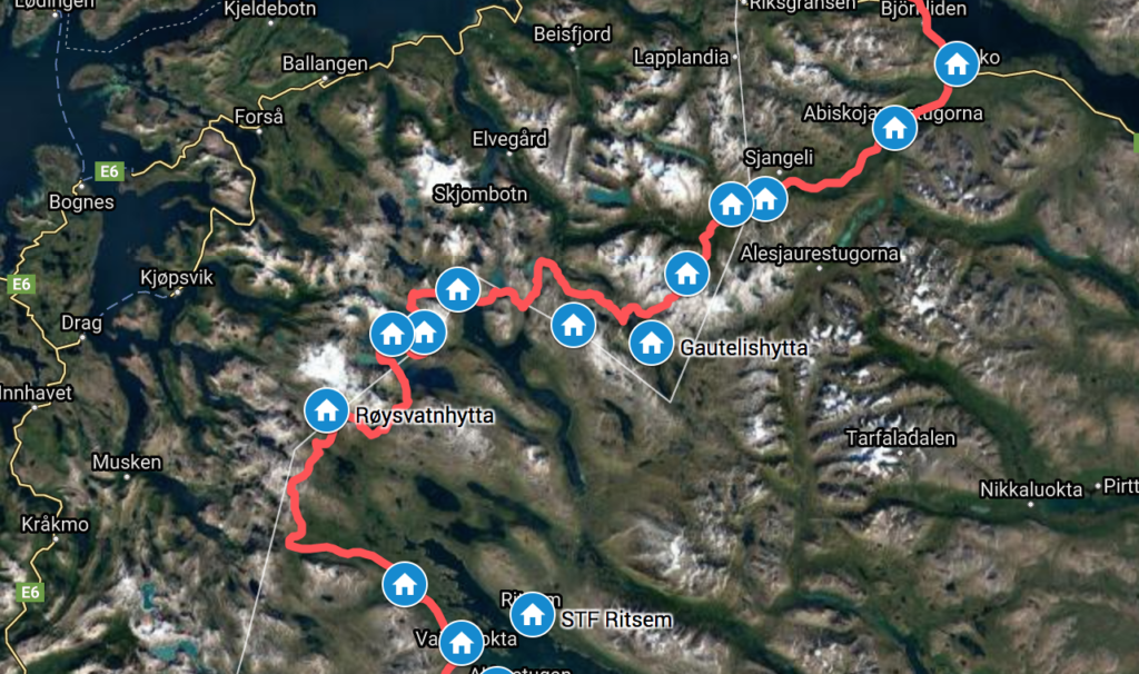
These last 97 km of Nordkalottleden were easy walking, with quite a few people as well on the trail, as some of it is part of the popular Padjelantaleden. The strenuous, but spectacular Narvik mountains, left me with a substantial deficit in my energy balance and I stocked up at Ritsem: Both with food and, also important, podcast downloads.
In 2012 the 19-year Danish hiker Joey Ravn disappeared without a trace in this exact area: While walking on Nordkalottleden, he decided to climb Allak from his campsite 3 km before the Kutjaure cabin, close to a a bridge. An area I passed through and I remember well the bridge. Despite intensive searches by local authorities as well as search expeditions from both Norway and Denmark the following years, he was never found. The area west/north-west of Virihaure is a massive wilderness though. A tragic as well as strange story, especially since the glacier-free Allak looks quite reasonable to summit, as opposed to the nearby Áhkká, where I initially thought he was lost.
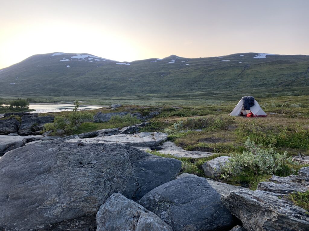
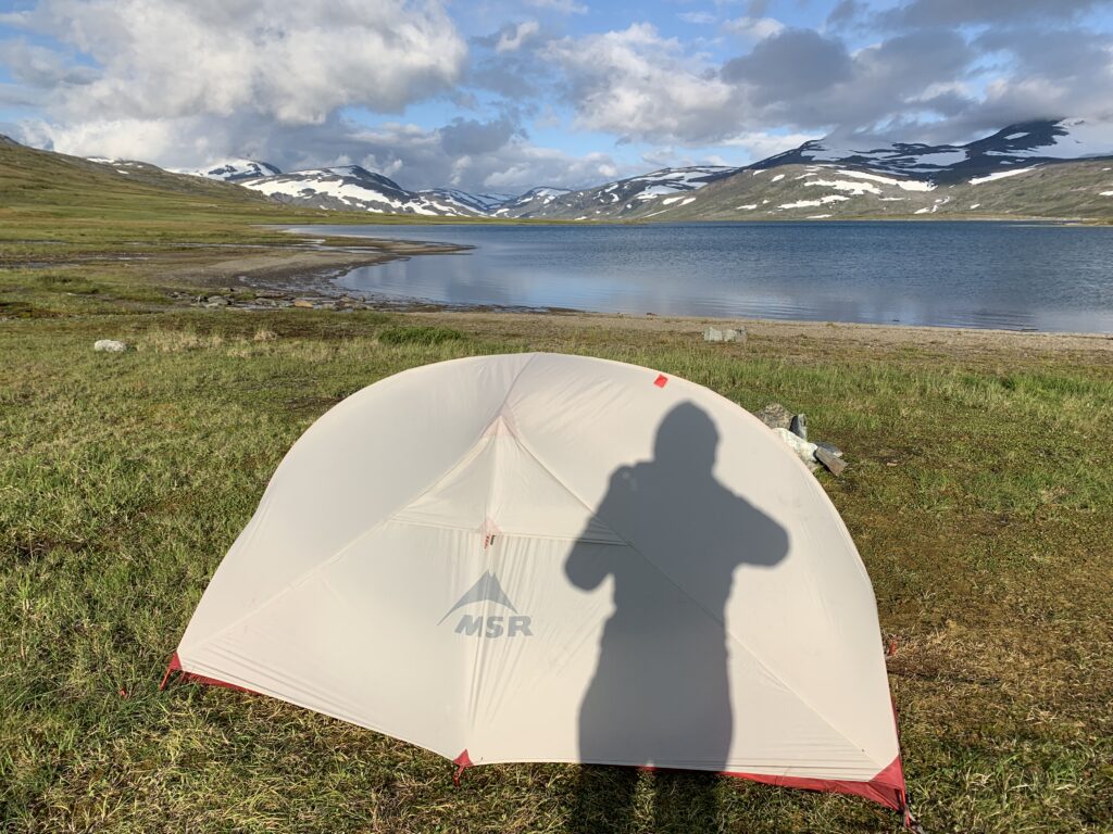
Camping by Miellädno, between Låddejåhkå and Árasluoka on Padjelantaleden
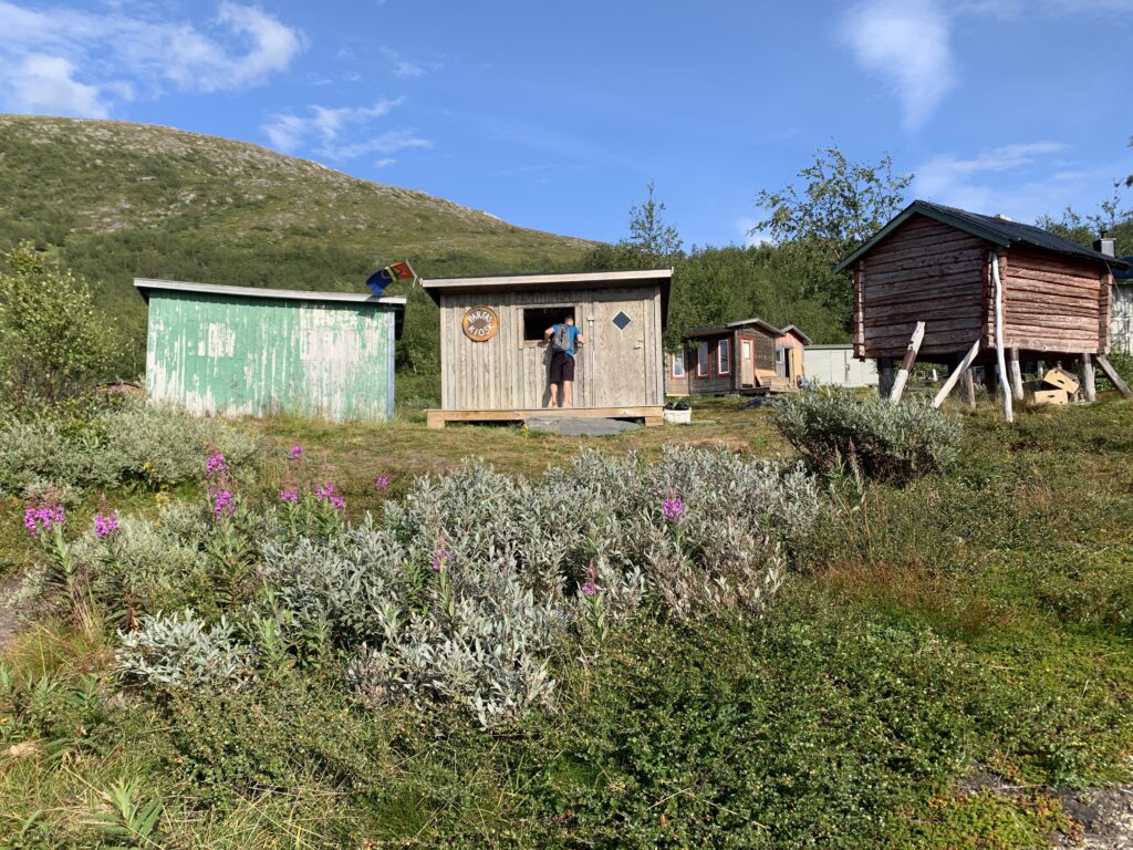
While all the DNT cabins in Northern Norway are without supplies (no-service), most of the Swedish cabins are quite well stocked and most, if not all of the Sami-staffed cabins on Padjelantaleden sell supplies in summer, brought up with snow scooter in the winter. The highlight in this regard wasParfa´s Kiosk in Stáloluoka, which quite simply sells everything you may want as a hiker, including freeze-dried meals and camping gas. I think I used more than 100 dollars there. Combined with fresh, baked bread and smoked fish from the STF Stáloluokta cabin, the days on minimum food were over, at least for the moment.
Parfa´s Kiosk in Stáloluoktá
The Swedish STF cabins, as opposed to the Norwegian no- and selv-service DNT cabins are typically staffed, which obviously ensures payment from the guests, higher quality of cleaning etc. The Norwegian no- and self-service DNT cabins operate on an honour-based system: Guests are supposed to register in a logbook and then, obviously, pay (several payment methods are available). In the vast majority of cases this system works well, but I have also stayed in huts with people who clearly do not register. And they are not only foreigners. I heard from locals volunteering in the cabins, that here in the North, where the cabins are more remote, theft of items like firewood may happen. I even heard about one tour company apparently arranging a winter skiing trip with scheduled overnight stays in several DNT cabins, without paying. They were found out by locals associated with DNT, who saw the advertisement for the trip on the internet and then went to visit the cabin on the day the tour company arrived, to catch them red-handed, so to speak. However, as I stated before, the vast majority of people, Norwegian or foreigners, do adhere to the rules.
Bridge near Sorjus
I have made it a habit every evening to reflect briefly on the most difficult moment of the day that passed. The crux of the day, I´d call it, borrowing a mountaineering term. Every evening I had to pick something, no matter how uncomplicated the day had been. Often it would be a river crossing, a slippery stone field, a steep snowfield or a scary bridge. Here in Padjelanta, with none of those events, and flat, easy terrain, the crux of the day could be something as uneventful as walking 200 m up a hill. Furthermore, immediately after the bigger river crossings I´d take a moment looking back on the place where I crossed, to evaluate what went well/less well and did I indeed chose the optimal place to cross after all.
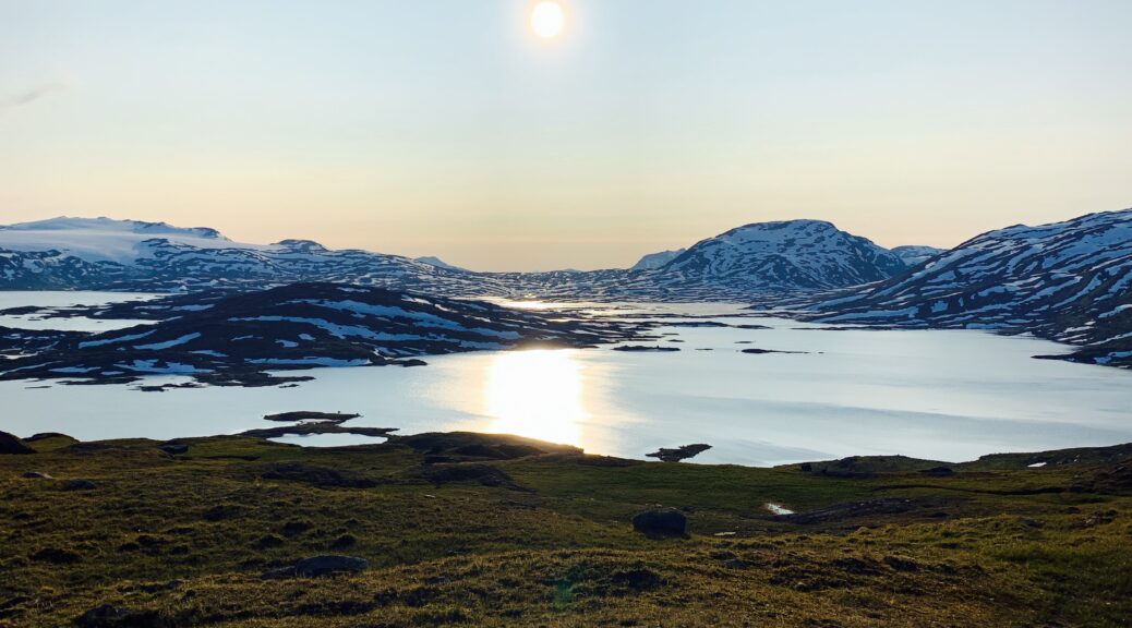
Sårjåsjávvre
Arriving in Sulitjelma meant I had completed the 667 km Nordkalottleden section of Norge på Langs. Future dream trip #5: From Hellmobotn along the trailless western shore of Virihaure to Sulitjelma. With packraft.
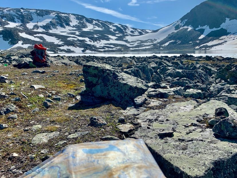
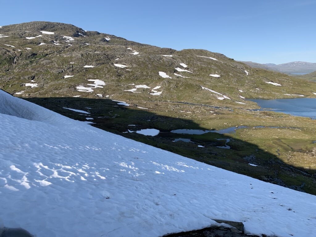
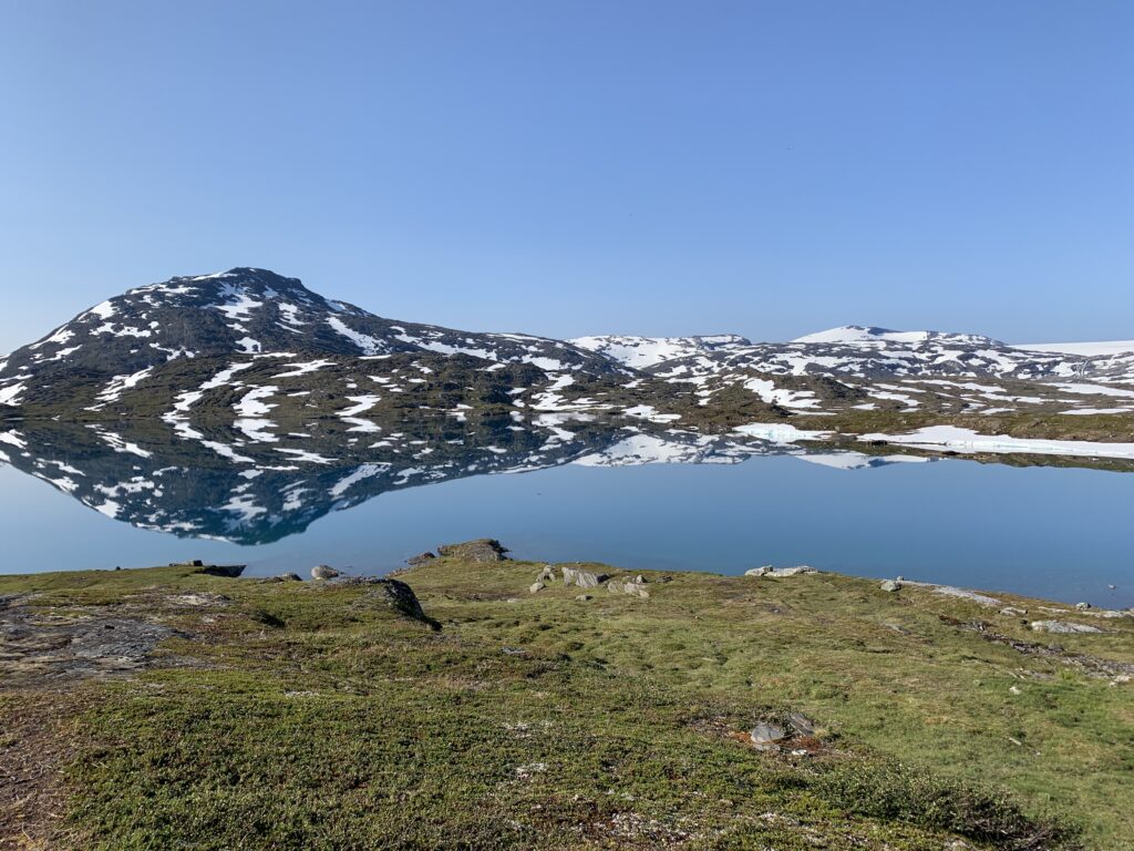
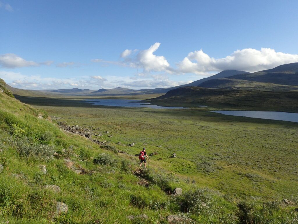
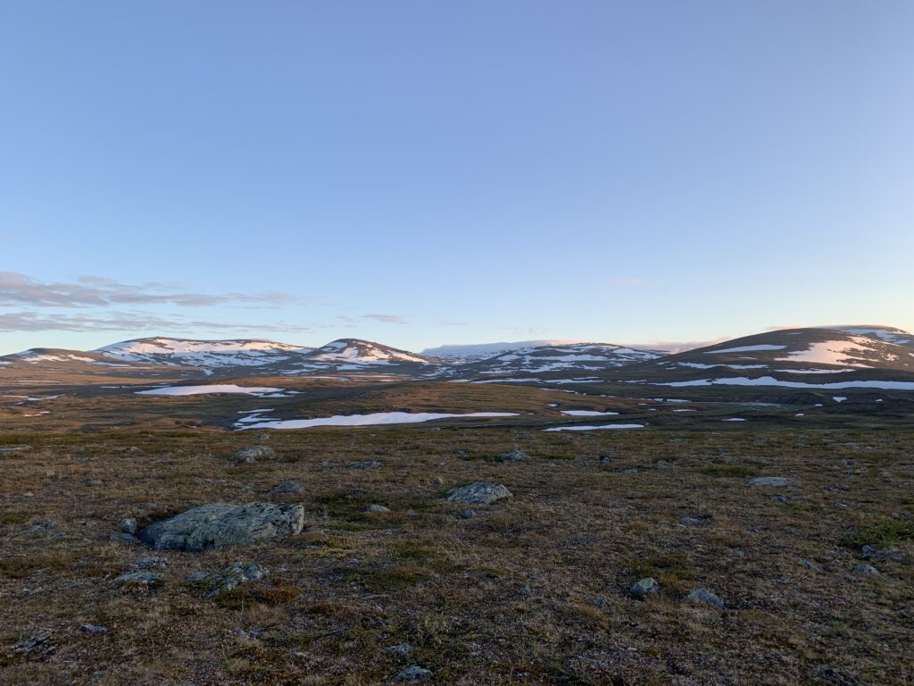
Glazing sun, 30 °C, glittering snowfields and glaciers, mirror-like lakes in tough terrain with boulder-sized stones, scary bridges, very steep snow fields and plenty mosquitos. Add to that: Questionable route marking in a terrain constantly switching between Norway and Sweden. Quite frankly I was sweating like a pig and I was constantly almost out of food. But it was also the most spectacular area of the entire Norge på Langs.
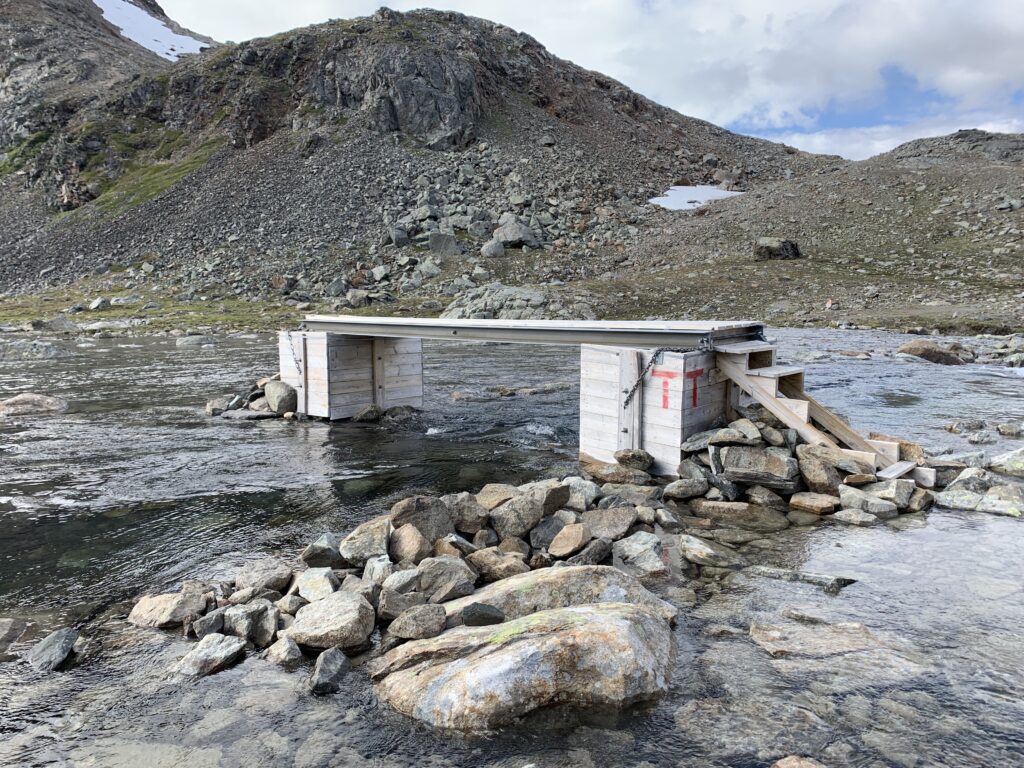
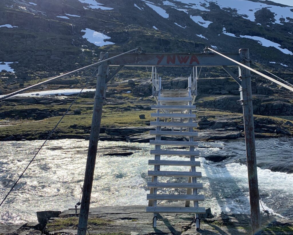
Swedish bridges = Massive steel constructions. Norwegian bridges= Small, wooden, very shaky looking constructions, not always spanning the entire river. No Norwegian bridges look more shaky than the ones in this area, the worst being the on right before Cunojávri: While a woman I met right before the bridge was giving up on it, I eventually crawled over resulting in a rather large tear in my pants as well as a broken side zipper. I see now (november 2020) that the Narvik branch of DNT have fixed the bridge. The terrain poses significant challenges influencing bridge construction: The weather is rough in winter with massive amounts of snow as well as strong winds. Consequently the spring flood may be enourmous. Furthermore, the remoteness of the area, makes any kind of maintenance challenging, especially in the area between Hellmobotn and Pauro. In this area, behind Tysfjord, Norge is only 12 km wide and at its smallest here.
The bridge right before Cunojávri
There were days, such as the one struggling through Cáihnavággi, where I managed less than 10 km in 10 hours. Crossing this bouldery pass was the toughest day since struggling with the rotten snow in Porsanger. At one point, jumping endlessly from one boulder to another I was so exhausted, probably combined with the insufficient calorie intake, that my mind started drifting: This mountain wall looks menacing.If I jump 7 stones in a row I will be safe. And similar things. Time to take a break, get some sugar (if I have some) and think rationally: Superstition is a sign of fear. Think rationally and everything will be ok. Do I have a physical issue? No. Then there is no reason not to move on.
Cáinhavággi cabins
I was, in theory, onminimum food regimen, expecting to complete this section in 10 days, carrying food for 12, and in the end using 14 days to reach the boat from Vaisaluoka to resupply at Ritsem. Luckily I found two packets of biscuits at a construction site near Sitas. And, while fishing at Baugevatnet, a German hiker on his way out spontaneously offered me some of his surplus food. So, despite having underestimated the terrain, I was never entirely without food. On a positive note, Unna Allakas, the last Swedish hut before entering the Narvik mountains was stocked like a supermarked, but the food and beer I bought there was gone within 2 days. In the end, my food stores were down to exactly zero when I stumbled into Vaisaluokta to take the boat to resupply in Ritsem.
Cáinhavággi
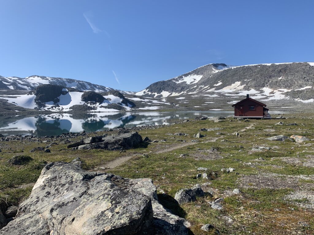
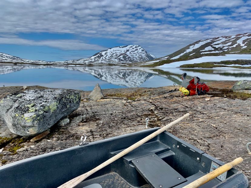
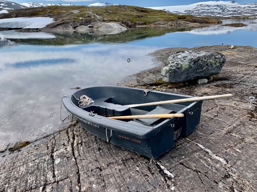
The moment the Pauro valley became visible over the mountain pass in the midnight sun was perhaps the single most beautiful moment of Norge på Langs and the featured image on top of this post. And if I am ever asked to name my favourite DNT cabin, such as they routinely do in the DNT podcast Utestemmer, my answer would be the Pauro cabin, right next to the perfectly still Båvrojávvre and right before infamous rowing section, the only one of the entire trip. To row over this 50 m stretch. there are two rowing boats. Ideally there will be one boat on each side and you then obviously have to row three times to again leave one boat on each site. A rowing guide for dummies illustrating this is even plastered on the wall in the Pauro cabin.
Preparing to row over Båvrojávvre
When I looked through the visitors book at Pauro cabin, I read about a couple arriving here last summer, with both boats on the other side. The weather then became quite bad and they were forced to turn back from the detour around Båvrojávvre, had to then spend a day in the cabin, risking to miss their boat out, two days further ahead in Hellmobotn. Then, luckily a hiker came from the south and they could cross. Curiously, the hiker, whose videos I watched before starting the trip, and who openly admitted she only rowed once, leaving no boat on the Pauro side, was here just the day before this couple wrote in the visitors book. There are alternatives to rowing, and really no excuse to leave no boat behind: Take the 8 km detour around the lake, for once. Or simply walk through the water: A 190 cm tall guy had managed to walk over carrying his backpack on his head earlier in the summer. Otherwise The sleeping pad method would work here: Inflate your sleeping pad, place your backpack on it, hold on to it and simply swim over. A friendly Sami couple, who owned some of the reindeer in the area seemed to have moved into one of the two DNT cabins, and told us they had helped someone with the rowing a couple of days earlier. While not particularly difficult, I was nevertheless quite happy a German couple with a dog happened to be crossing at the same time.
Luckily there is a boat on my side. And one on the other side as well.
Two weeks later, a new bridge was built here. Price: 800.000 NOK. It will be interesting how it goes, as several bridges have been built here before, all broken down, presumably due to particular geologic conditions as well as massive amounts of snow and strong side winds. It is mainly due to these bridges I decided to become a member of the Narvik branch of DNT. As foreigner you are automatically assigned to DNT Oslo, but DNT will change it upon request. I figured that my membership fee would be more needed in Narvik with ~ 900 members than in Oslo, with ~ 40.000 members and significantly fewer logistic as well as meteorological challenges.
Looking back on a very steep snowfield just before Pauro. I had to walk around it.
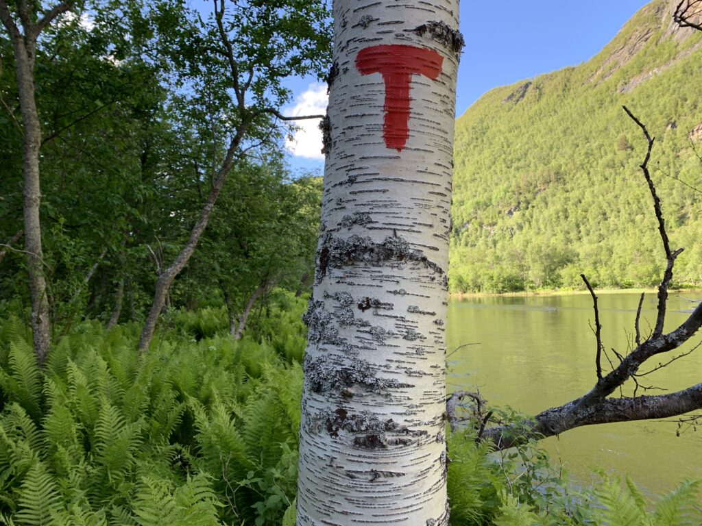
The trail switches constantly between Norway and Sweden. Several local people have told me, that some Sami routinely remove the trail markers in areas they don´t want people to pass through as they feel the hikers disturb the reindeer. Whether true or not, obviously I do not know, but the fact is that the part of Nordkalottleden behind Tysfjord is not well marked, especially the Swedish sections.
Båvrojávvre, view from Pauro cabin
For two weeks I had heard trail gossip about the river crossing just south of Røysvatn: Impassable, take the detour via Ritsem, several said. Well, the detour and especially the following motor boat over Akkájavre would be a violation of one of the core principles of my hike: To walk 100% of the way, so that was not an option, except in an emergency. I studied ut.no meticulously for possible detours to the west trying to estimate the size of the rivers in the area. But difficult to know where it is possible to get through, the terrain is tough, full of crevices and small vertical drops, to small to be seen on the map, but far too big to pass. Since taking the detour to Ritsem would equal giving up on the entire trip, I had no choice but to give it a try.
Looking back at the infamous unnamed river from Skáiddejávri to Sårgåjavvre (border cairn 250A)
Distracted by this river issue, I even took a wrong turn down the pass right before Røysvatn, thereby missing the cabin as I, for some strange reason, didn´t trust my GPS, and thus accidentally ended up camping quite near this river: The plan was to attempt the crossing in the morning, where the water levels in this period of +25°C with lots of snow melting would be significantly lower than in the afternoon. So, after worrying for more than a week about this river, and building up to this crossing for days, in fact…it was quite uncomplicated. A couple of meters with water reaching the middle of the thigh, but the rest not above knee level. Again: A lesson already learned, but once again reinforced: Never listen to trail gossip from strangers: You do not know their level of experience nor their mindset, and furthermore people in general seem to overestimate the challenges they just overcame themselves. In addition weather, and especially river conditions may change rapidly, within hours. This crossing by the way is in Sweden, and considering the number of hikers who report problems here, a bridge should be considered. 100 m upstream from the crossing place, there even is a perfect place, where the river is no more than 10 meters wide.
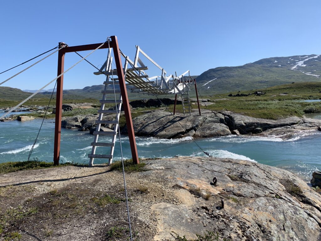
The Liverpool bridge right next to Baugebua
Future dream trips #4: With packraft in the area Sørfjorden-Pauro-Røysvatn-Hellmobotn. Entry via Hellmobotn or perhaps Ritsem
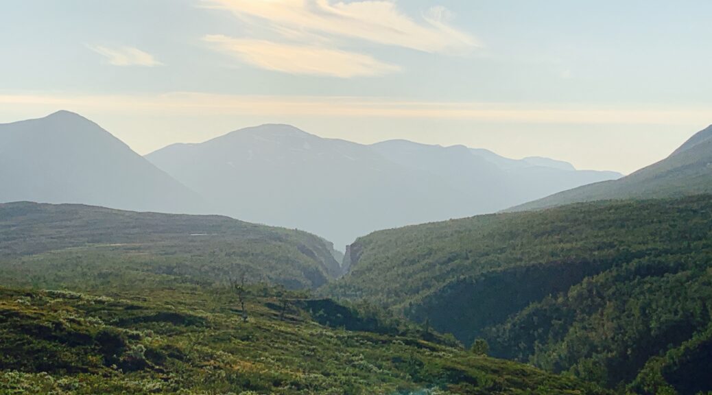
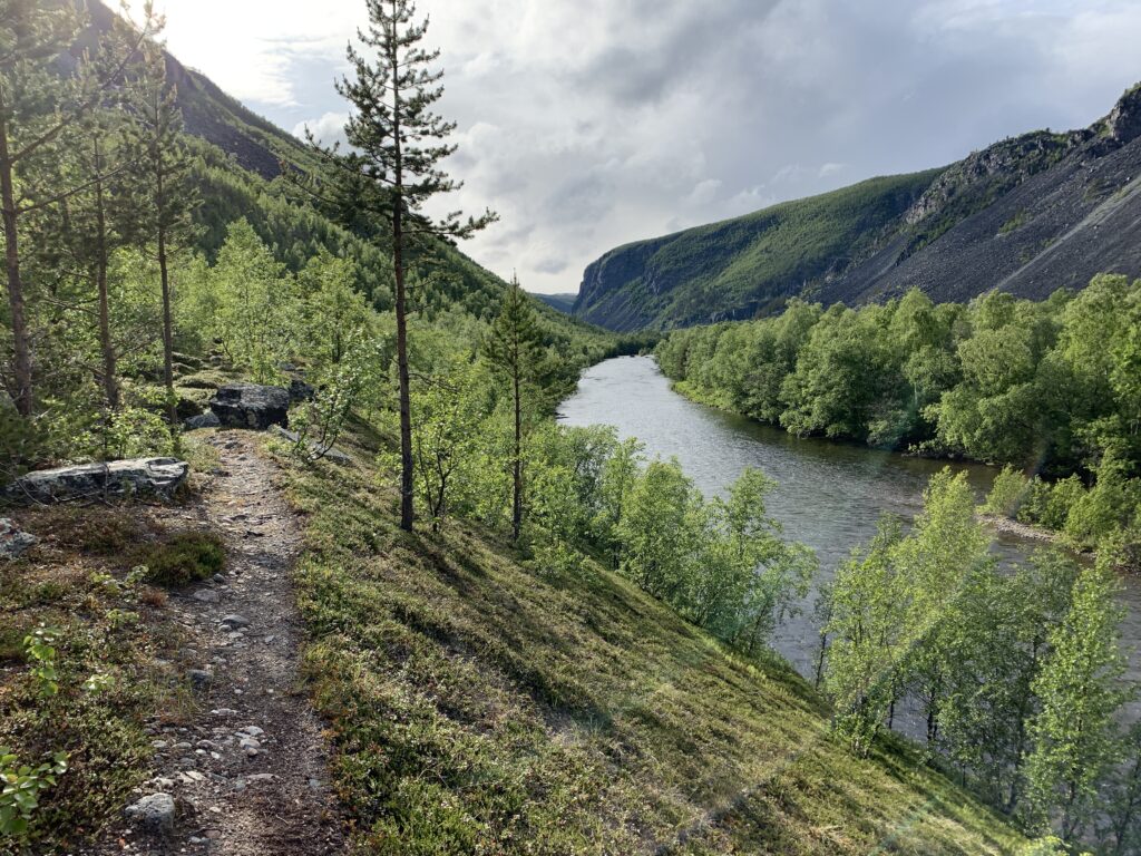
The magnificent open wilderness, combined with relatively easy walking, well-marked trails and excellent cabins has made the 10-day hike from Kilpisjärvi to Abisko through Øvre Dividalen National Park, one of the more popular in Northern Norway. Popular, in this context, meaning I would meet 2-3 other people when passing the cabins, and perhaps see a couple of tents near the trail every day, not more than that.
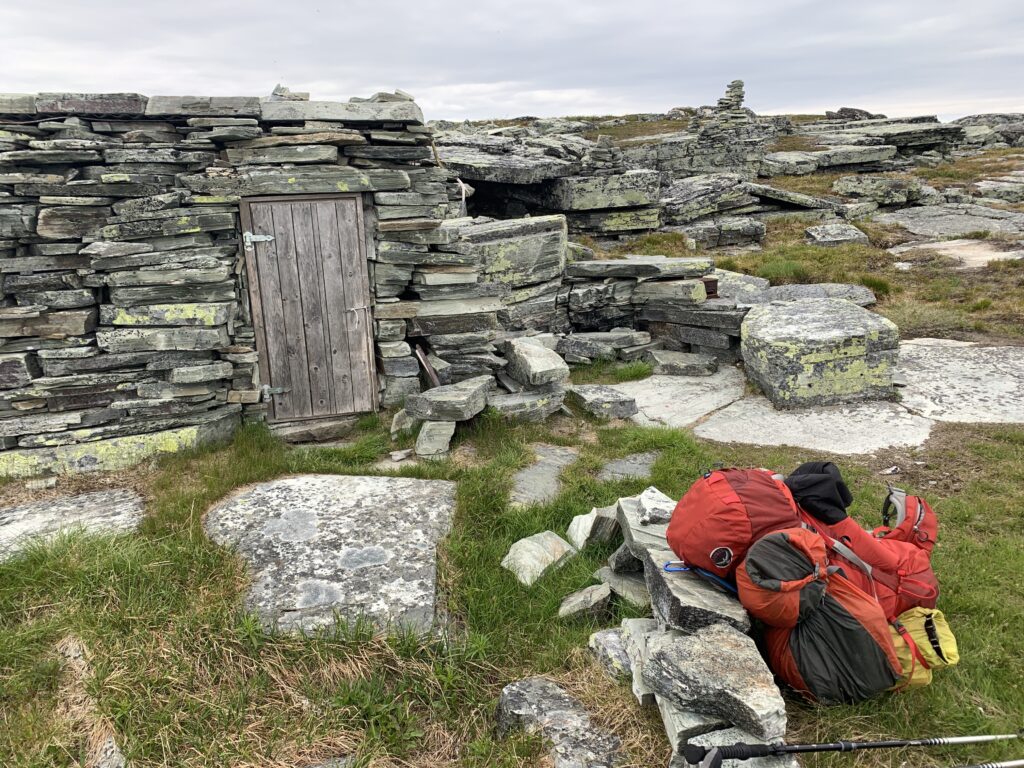
Stone cabin off-trail between Pältsa and Dærta in Rostadalen
This is one of the few sections I have walked before, in 2018, though in the opposite direction. And for this reason, I decided to take an unmarked shortcut from Pältsa to Dærta crossing Rostaelva by the marked (ut.no) stone cabin, thus skipping the Rosta cabin. While saving me around 10 km I am not convinced I actually ended up saving much time as the terrain is rough with plenty of boulders and 5-10 m crevices, not visible on the map. Furthermore, the crossing of Rostaelva by the stone cabin (further down there is a bridge) was the biggest river crossing so far. Crossing a snowfield by a lake high up in the midddle of the short-cut I wondered if I was the only person having ever walked in this exact area. Until I saw a tent and two men from far on the other side of the lake.
Near Dærta
Upon reaching the Dærta cabin I met a Swedish guy attempting to set a speed record on the Swedish long-distance trail “Gröna Bandet”. He had started out the same morning from Treriksröset (border between Norway, Sweden and Finland close to Kilpisjärvi) having thus walked around 40 km. His plan was to walk 60 km the following day, but he was negatively surprised by the stony terrain, which prevented him from running as fast as he would have liked to. I later looked him up on Instagram and found out he quit his record attempt with a muscle injury in Abisko.
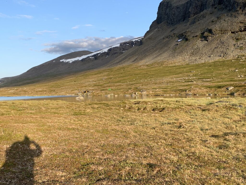
The Kissing Lakes, between Dærta and Dividalen
Though not the area with the most bears in Norway (that would be Pasvik), Dividalen is nevertheless well-known for hosting bears. They live predominantly in the side valleys, such as Anjavassdalen, where bears are spotted every year, mainly on the northern bank of the river, opposite of the tourist trail. I reasoned that by walking down an unmarked trail in another side valley, Skaktardalen, around midnight I would maximize my chances of meeting a bear, but in vain. June-August is normally considered the safest period to see bears, as they have finished their initial post-winter eating rush. Skaktardalen, at least the upper part, is perhaps, in hindsight, probably too open to provide an optimal environment for the bears, who prefer more vegetation. However, walking down Skaktardalen in the midnight sun on an unmarked path to reach the historic, open Ole Nergård cabin down by the main river was one of the highlights of the entire trip.
Ole Nergårdbua in Dividalen
The Vuoma cabin next to the lake stands out as it is on of an increasing number of DNT cabins built in semi-modern architectural style, with a huge window overlooking the lake. The Vuomavatnet, famous for ice-fishing in winter, is where I tried to fish for the first time ever, back in 2018. Unsuccessful, and after my fishing hook twice got stuck in the stones I gave up. According to senorge.no there would still be some snow over the highest passes close to Vuoma, but it turned out to be almost gone, leaving patches with hard, dry summersnow. Future dream trip #3: Dividalen-Havgahytta-Irgassjavri-Vuomavatnet and this area. With packraft.
Altevatn, looking towards Gaskas on the northern shore
Altevatn was the location for the first couple of seasons of the Danish reality TV show ”Alene i vildmarken” (Alone in the Wilderness). Altevatn, however, is far from a wilderness, especially near the western with multiple huts and ATV tracks all over the place. I wonder where the TV show was filmed. Probably around the eastern end, close to Politiodden. But with 10 km between the participants campsite, they must have used a considerable part of the lake.
Lapporten, the entrance to the mountains surrounding Kebnekaise. View over Torneträsk
From Altevatn it is a two days walk over the mountains and down to Torneträsk and Abisko.
Having basically not met anyone on the trail since Knivskjellodden, I was quite surprised to find the Finnish cabins packed with people.
The reason is Finland´s highest mountain Halti. At 1365 m it is in fact not that high by Norwegian standards, furthermore the true 1365 m summit is technically located in Norway, with a several slightly lower summits close by on the Finnish side. Apparently Norway has considered giving Finland a higher summit than the one they have now. The most common access to Halti is via the E1 hiking route in Kilpisjärvi, which explained the +20 people I met on the trail every day, the highest number of the entire trip. Famous for the forests and “thousand lakes”, this is Finland´s only high alpine area and I would constantly hear complaints on the trail about the stony terrain. Compared to DNT standards, the cabins are primitive, but completely fine, on the other hand they are free and I expected to leave my tent in the bag, however after passing hut after hut packed with people I changed my mind.
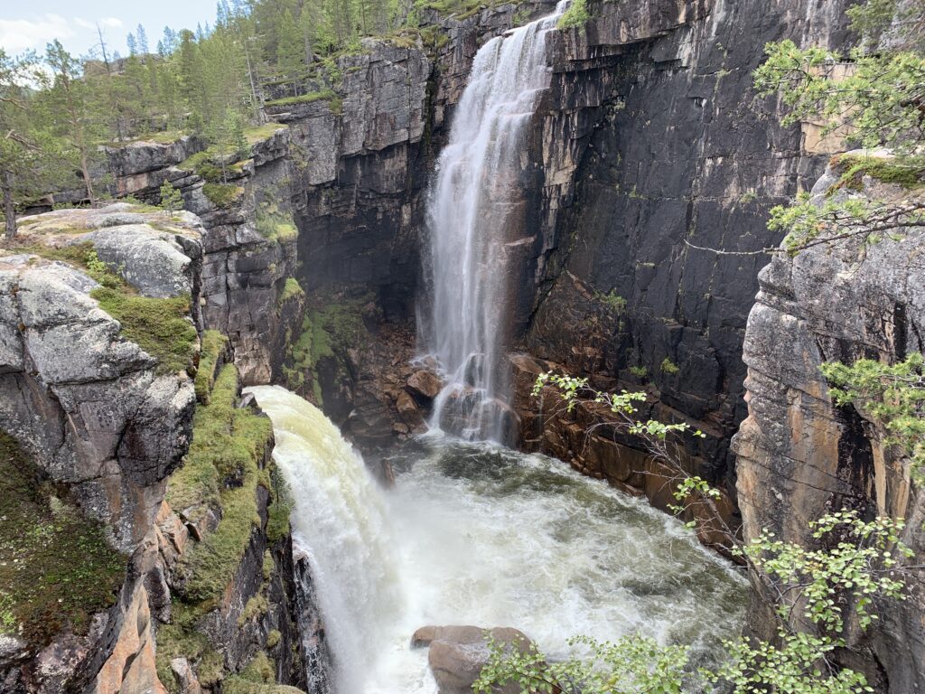
The most famous attraction on this section is probably “The Niagara of Finland”, the largest waterfall in Finland: Pihtsusköngäs, .
Camping near Pihtsusköngäs
Much to my irritation I lost my bag of food outside Ovi Raishiin visitor point in Reisadalen while chatting with a park ranger, leaving me with 5 pieces of Kvikklunsj for the remaining 95 km to Kilpisjärvi. Something I only realized when I was already on the mountain plateau, 25 km from the valley and ready for a snack. Having mentally prepared myself to eat only 1,5 Kvikklunsj per day, I was much surprised when, 10 km later I arrived at the Somas cabin: There I found both mashed potato powder, oatmeal as well as several soups, more than enough to eat reasonably well until Kilpisjärvi.
Pihtsusköngäs, The Niagara of Finland
Quite frankly, due to my broken boot, which constantly cut into my right big toe, making every step painful no matter what I did, I struggled to get through these 95 km. It was a priority to catch the Friday evening bus from Kilpisjärvi to Tromsø and I would walk until long past midnight to be sure I made it. Several times a day I went through the same internal dialogue: Is the situation dangerous or just unpleasant? It is not dangerous. Is there a physical problem preventing me from walking? Well, not exactly preventing, but it is painful. Then, the challenge is mainly mental, and I will just have to move on.
The plateau around Somashytta
The detour to Tromsø, by the way, cost me almost 3 days on the trail. On the upside I got the best hiking boots I have ever had, probably the first time I have succeeded in buying big enough boots. I also had the most expensive pizza in my entire life, costing more than 200 NOK as I remember it.
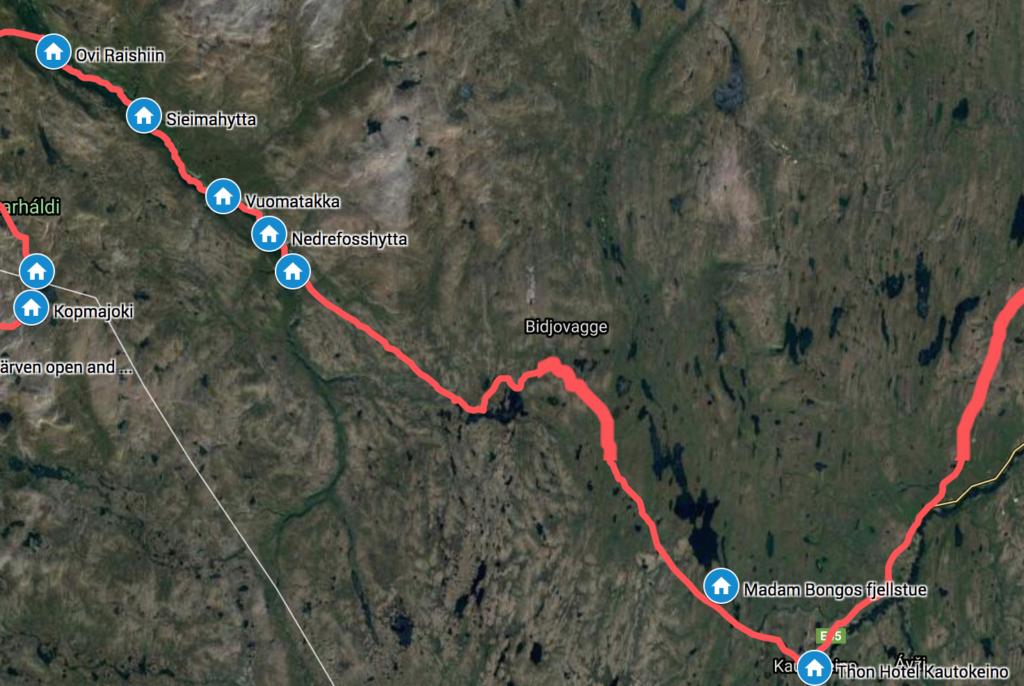
Kautokeino is the starting point of Nordkalottleden, and you start by making a choice: To either walk 15 km in knee- and thigh-deep mud until Madam Bongos Fjellstue, or tp walk on the paved road, parallel with and close to the muddy trail. The uneventful. road it was for me. Later, in Kilpisjärvi I met a German hiker, who desperately called her boyfriend in Germany as she found herself stuck here in thigh-deep mud. She had no idea there was a nice, paved road less than one kilometer away (potential lesson to learn: Look at the map).
The trail from Kautokeino down Reisadalen to Saraelv is one of the designated Historic Hiking Routes, with plenty cultural traces, such as hunting groves and murals dating back as far as the Stone Age. Parallel to the valley on the high plateau the reindeer have moved between Kautokeino and the summer pastures closer to the sea for centuries.
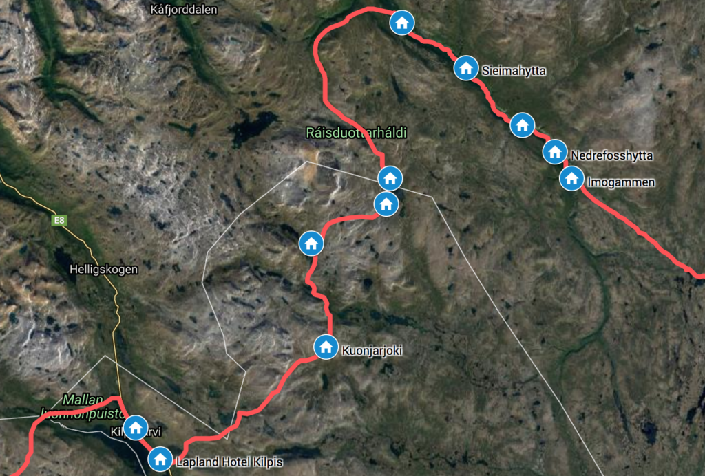
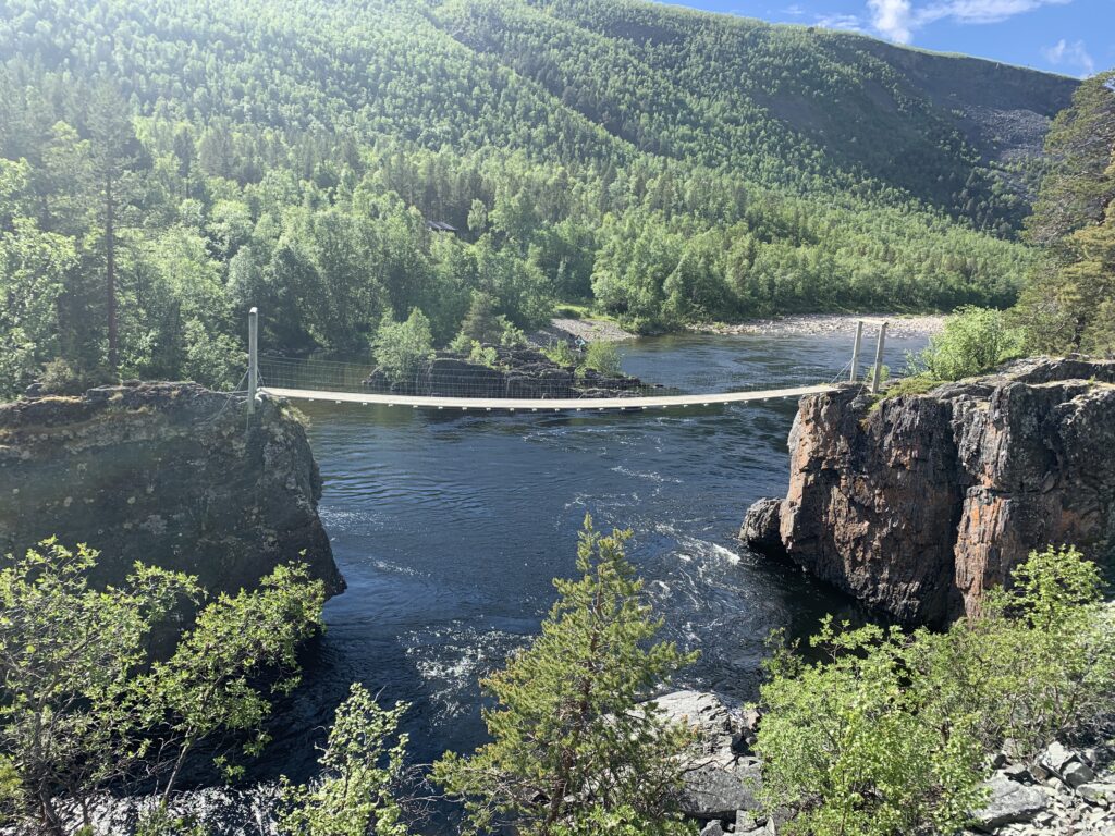
The bridge at Nedrefoss
If it had not been so far north and swamped with mosquitos during the summer months, Reisadalen would be swamped with tourists. I was astonished to learn that the vast majority of Norwegians I met in the mountains further south had not even heard of Reisadalen. Never heard of Reisadalen, perhaps the most magnificent valley in the whole country? Unbelievable. Reisadalen is a magnificent canyon-type valley of the kind most do not associate with Norway. Lined with several spectacular waterfalls, most notably Imofossen and Mollisfossen, as well as fabulous open log cabins.
Once again, my arrival was well-timed: Almost 24 h sun, temperatures around zero and no mosquitos.
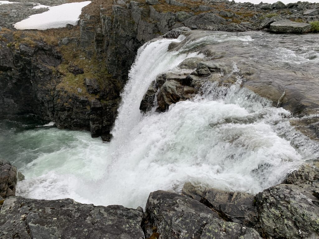
Imofossen
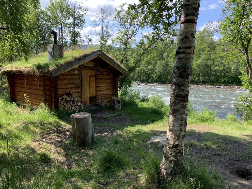
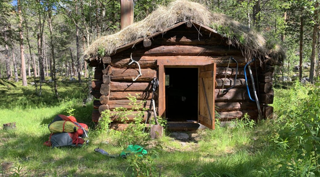
The greenhouse effect down in the valley results in a path often overgrown with meter high vegetation as well as being frequently eroded along the river bank. Nevertheless, from Imofossen it is perfectly possible to walk the 30 km down into Reisdalen until the Ovi Raishiin Visitor Point near Saraelv in one day. However I spent three days, mainly due to a string of four wonderful open log cabins, complete with cooking equipment and firewood. I stayed at two of them, Imogammen and Vuomatakka, and it genuinely felt like staying in a museum. The cabins are free and maintained by Statskog. I passed several similar cabins further on such as Ole Nergårdbua (Dividalen) and Verdalen (Virvassdalen). Imagine free huts like that in populated areas such as Jotunheimen or Hardangervidda? They would get ruined in a week.
Overgrown trail in Reisadalen
On the way down from Imofossen into the valley I passed ”The famous metal ladder”: I had heard many rumours about this 50 m vertical metal ladder ending right in the water with no way to go other than turn back onto the main trail. The rumours were right, there was indeed nowhere to go from the bottom of the ladder and I did not even dare to crawl down to look. But, instead of turning back, I decided to try and scramble down the rocky terrain in front of me, and suddenly 100 meters further on, the trail markers suddenly appeared. A couple of locals later told me, that this metal latter is NOT part of the trail, it is made for salmon fishers. The hiking trail, unfortunately unmarked at this point, passes to the right just before the metal ladder descends into the water. Nedrefoss, with the only bridge as well as the DNT cabin, marks the transition from the upper to the lower part of the river, and from this point the river flows gently down all the way to the ocean. Future dream trip # 2: Walk up to Jiertafossen (via Nedrefoss) from the parking and paddle down Reisaelva (probably from Nedrefoss) in my packraft. Find the log cabin Arturgammen, which I missed during this trip.
Approaching Imogammen, the open log cabin close to Imofossen
Walking down the floor of valley, I did not meet any hikers, but noticed quite a lot of traffic on the river: It turned out I arrived on the eve of the beginning of the salmon fishing season, and quite a few fishermen rode boats up the river to secure the best camp spots. The salmon travel all the way up to Imofossen and a total of 531 salmon (the biggest weighing 18,5 kg) were caught in Reisaelva in 2019, comparable to previous years, but a big decline compared to the situation 20 years ago. At Sieimma, a couple of salmon fishers sat around a fire. Very kindly, I was offered a boat ride the final 7 km down to Saraelv, something I obviously politely refused.
In the Vuomatakka cabin I learned Lesson # 8: Do not place your leather boots too close to the fire. Or at least that is my explanation for the fact that the inside of my right boot became deformed with a spike cutting right into my right big toe, impossible to remove, despite several hours of soaking the boot and cutting on the spike from the inside. From Vuomatakka it is 105 km to Kilpisjärvi, but getting out of Reisadalen and down to Storslett is a major hassle as well, so I decided to try to make it to Kilpisjärvi, where there is an almost daily bus to Tromsø.