Kautokeino is the starting point of Nordkalottleden, and you start by making a choice: To either walk 15 km in knee- and thigh-deep mud until Madam Bongos Fjellstue, or tp walk on the paved road, parallel with and close to the muddy trail. The uneventful. road it was for me. Later, in Kilpisjärvi I met a German hiker, who desperately called her boyfriend in Germany as she found herself stuck here in thigh-deep mud. She had no idea there was a nice, paved road less than one kilometer away (potential lesson to learn: Look at the map).
The trail from Kautokeino down Reisadalen to Saraelv is one of the designated Historic Hiking Routes, with plenty cultural traces, such as hunting groves and murals dating back as far as the Stone Age. Parallel to the valley on the high plateau the reindeer have moved between Kautokeino and the summer pastures closer to the sea for centuries.
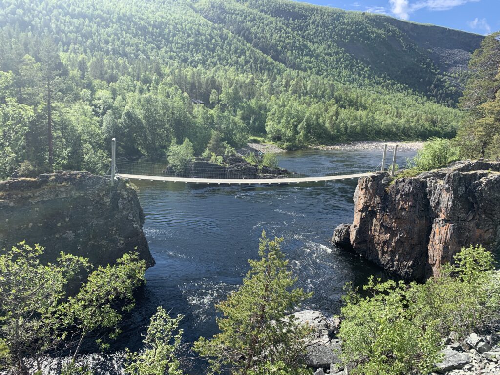
The bridge at Nedrefoss
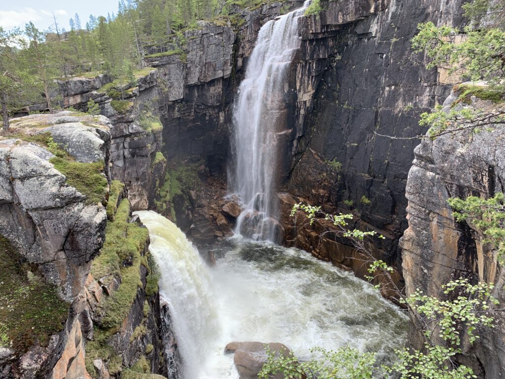
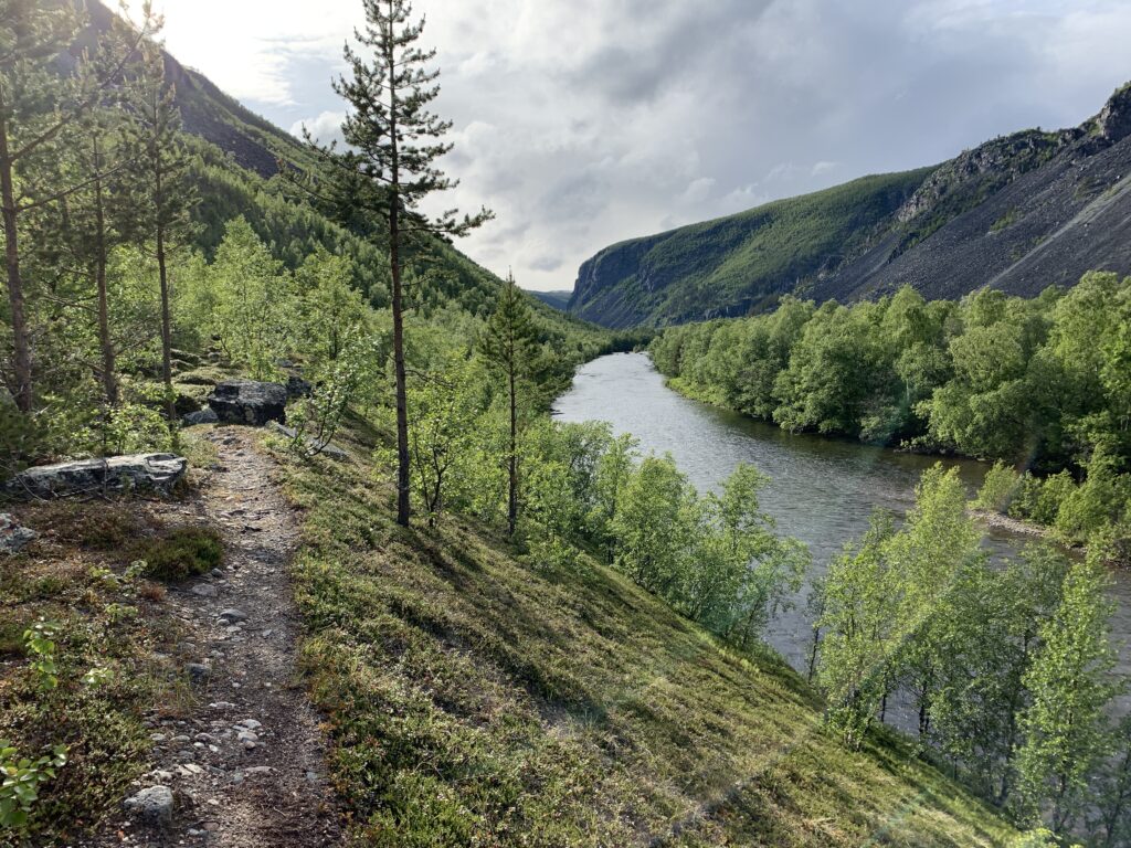
If it had not been so far north and swamped with mosquitos during the summer months, Reisadalen would be swamped with tourists. I was astonished to learn that the vast majority of Norwegians I met in the mountains further south had not even heard of Reisadalen. Never heard of Reisadalen, perhaps the most magnificent valley in the whole country? Unbelievable. Reisadalen is a magnificent canyon-type valley of the kind most do not associate with Norway. Lined with several spectacular waterfalls, most notably Imofossen and Mollisfossen, as well as fabulous open log cabins.
Once again, my arrival was well-timed: Almost 24 h sun, temperatures around zero and no mosquitos.
Imofossen
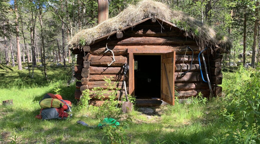
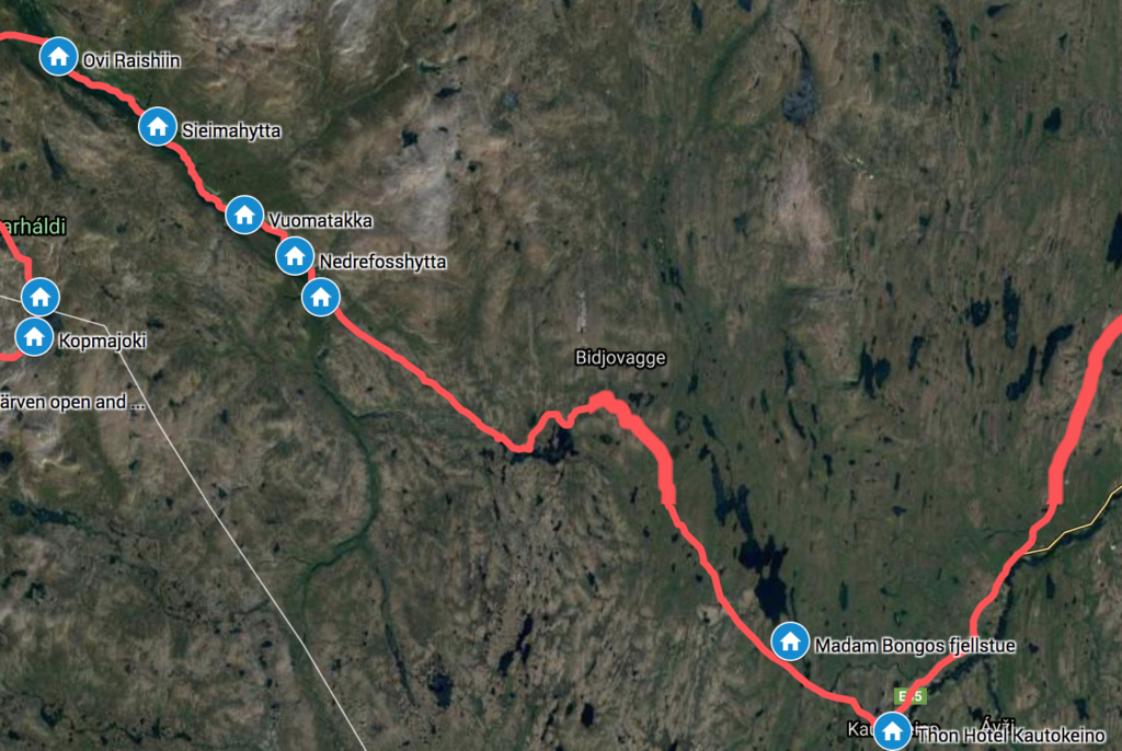
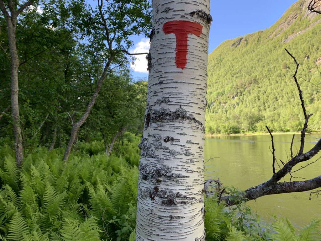
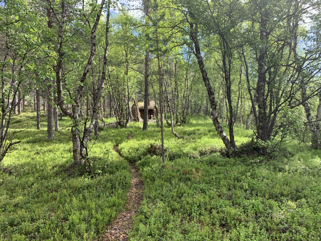
The greenhouse effect down in the valley results in a path often overgrown with meter high vegetation as well as being frequently eroded along the river bank. Nevertheless, from Imofossen it is perfectly possible to walk the 30 km down into Reisdalen until the Ovi Raishiin Visitor Point near Saraelv in one day. However I spent three days, mainly due to a string of four wonderful open log cabins, complete with cooking equipment and firewood. I stayed at two of them, Imogammen and Vuomatakka, and it genuinely felt like staying in a museum. The cabins are free and maintained by Statskog. I passed several similar cabins further on such as Ole Nergårdbua (Dividalen) and Verdalen (Virvassdalen). Imagine free huts like that in populated areas such as Jotunheimen or Hardangervidda? They would get ruined in a week.
Overgrown trail in Reisadalen
On the way down from Imofossen into the valley I passed ”The famous metal ladder”: I had heard many rumours about this 50 m vertical metal ladder ending right in the water with no way to go other than turn back onto the main trail. The rumours were right, there was indeed nowhere to go from the bottom of the ladder and I did not even dare to crawl down to look. But, instead of turning back, I decided to try and scramble down the rocky terrain in front of me, and suddenly 100 meters further on, the trail markers suddenly appeared. A couple of locals later told me, that this metal latter is NOT part of the trail, it is made for salmon fishers. The hiking trail, unfortunately unmarked at this point, passes to the right just before the metal ladder descends into the water. Nedrefoss, with the only bridge as well as the DNT cabin, marks the transition from the upper to the lower part of the river, and from this point the river flows gently down all the way to the ocean. Future dream trip # 2: Walk up to Jiertafossen (via Nedrefoss) from the parking and paddle down Reisaelva (probably from Nedrefoss) in my packraft. Find the log cabin Arturgammen, which I missed during this trip.
Approaching Imogammen, the open log cabin close to Imofossen
Walking down the floor of valley, I did not meet any hikers, but noticed quite a lot of traffic on the river: It turned out I arrived on the eve of the beginning of the salmon fishing season, and quite a few fishermen rode boats up the river to secure the best camp spots. The salmon travel all the way up to Imofossen and a total of 531 salmon (the biggest weighing 18,5 kg) were caught in Reisaelva in 2019, comparable to previous years, but a big decline compared to the situation 20 years ago. At Sieimma, a couple of salmon fishers sat around a fire. Very kindly, I was offered a boat ride the final 7 km down to Saraelv, something I obviously politely refused.
In the Vuomatakka cabin I learned Lesson # 8: Do not place your leather boots too close to the fire. Or at least that is my explanation for the fact that the inside of my right boot became deformed with a spike cutting right into my right big toe, impossible to remove, despite several hours of soaking the boot and cutting on the spike from the inside. From Vuomatakka it is 105 km to Kilpisjärvi, but getting out of Reisadalen and down to Storslett is a major hassle as well, so I decided to try to make it to Kilpisjärvi, where there is an almost daily bus to Tromsø.
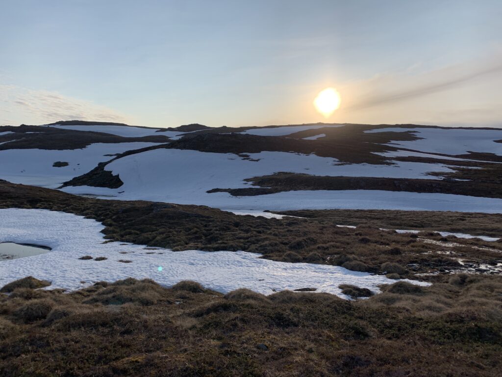
The crossing of Finnmarksvidda was quite simply magnificent and one of the highlights of the entire trip: The sun was out 24 hours a day, no mosquitos, temperatures just above zero and no wind. Considering the tent I brought, I was extremely lucky, especially regarding the wind. The major part of snowmelt was over, there was practically no snow left and the water level in the rivers was reasonable. I did not have one single, problematic river crossing. I did, however avoid the, in theory, largest crossing: Skaidielva, by taking a detour around Skaidijavre.
I´d start walking in the early afternoon and walk until well past midnight into the magic hour (around 1 am, beware summertime) where the light changes from dusk to dawn with the sun always on the horizon.
Finnmarksvidda may be flat seen from space or on a map, but walking on it, there are many small 50 m hills, making trailless navigation not too easy indeed. I did bring an old paper map, but too late I realized it covered only Stabbursdalen national park. The only landmark my Garmin GPS recognizes in this part of Finnmarksvidda is Skaidijavre. I had not succeeded to find any trails to download before the trip. However, as both the GPS on ut.no and norgeskart worked offline on my iPhone, my GPS only left my backpack when I tried to slot down the easiest way to walk around the trailless northern shore of Skaidijavre. I did notice however, that the actual trail did not 100% correspond to the trail as marked on ut.no, though it rarely deviated more than 100 m, and the markers not always easy to spot.
On a slightly more negative note, one of the blisters I got on the first day had gotten infected. Luckily, having treated many such cases, I know there is no need for antibiotics, just plain washing and as much air as possible, not always easy when walking. However, after a couple of days with extensive “treatment” – ie pausing regularly to air the toe, sleep without socks etc., the infection subsided.
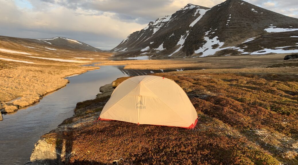
Camping at Skaidijavre.
I camped the first night next to Skaidielva, around 15 km downstream from its origin at Skaidijavre, and where it should be crossed when following the E1. But after having heard from what I judged to be reliable sources (two men completing Norge på Langs winter version) that the river was waist-deep, I took an off-trail detour around Skaidijavre. I later saw pictures indicating I could probably have crossed it, which reinforcedlesson #1: Never make trail decisions based on hear-say, always assess the area yourself. A rule I followed for the remainder of the trip.
In any case, Skaidijavre is a stunning lake, especially in the midnight sun though I did have to move from my intended campsite around midnight as I was attacked by very aggressive diving birds. I have encountered these attacking birds also on Sørøya and, though I am not sure, I believe they may be called fjelljo. At the eastern end of Skaidijavre I passed two cabins, marked as open, but for some reason they were not. Since I passed right before midnight I did wonder if they were simply locked from the inside by someone sleeping.
Open (in theory) cabin at the eastern end of Skaidijavre
Crossing Stabbursdalen national park, the E1 hiking trail does not go down to Stabburselva, the heart of the park, but stays on the plateau. Future dream trip #1: Paddle down Stabburselva in my packraft. Ideally starting from Karasjok and paddle Iesjavri as well on the way.
A days walk or so south of Stabbursdalen I arrived at the first DNT cabin: Bojobæski. Up here in the north all the DNT cabins are no-service, meaning there are no provisions, but otherwise they are of at least a similar standard as seen elsewhere in Norway. Many, including Bojobæski, are locked with The DNT Key, available to all DNT members upon paying a small deposit. Unfortunately, when struggling to unlock the cabin, I realized I had taken the wrong key with me: Instead of my DNT key, I had brought the the key for my old cupboard. As I prefer to have the key for safety reasons, I rang the local DNT section in Alta as soon as I reached a hilltop with phone connection. Turned out the easiest way to get one was to get off-trail at Masi three days further on, take the bus to Alta and get it there. I could then profit from the occasion to replace my woolen pants as well, as it turned out those I had with me were halfway eaten by moth.
When I arrived at Jotka Fjellstue, supposed to be open all year, only a couple of wildlife researchers from University of Tromsø were there. The staff were on a short trip to Alta. Lesson learnt #7: Never rely 100% on remote places to be open, in particular: Don´t eat all your food and count 100% on resupplying in such places. Jotka is, by the way, not that remote and it is one of the major cabins on Finnmarskvidda, right at the western entrance, the last check-point on Finnmarksløpet. Often dog mushing teams spend several months here during winter, witnessed by the numerous dog shoes on the trails in the area.
The area around Masi is heavy reindeer territory and here I met the first person on the trail since Knivskjellodden: A very friendly sami checking the reindeer fence on his MTV. He even proposed a nice campsite, in the between two lakes in the middle of the reindeer breeding ground. The extensive ATV driving in this area is very visible and routes and reindeer fences are often not marked on maps. I took an unmarked trail, which I thought to be the quickest way from Jotka to Masi: In fact, this turned out to be a well-drilled ATV trail following a reindeer fence all the way.
Coincidentally, the day I arrived in Masi was the exact day the mosquitos arrived on Finnmarksvidda. Masi, a sami village is located around 15 km upstream from the massive Alta Dam by the Kautokeino-Alta river. The Alta Dam still well known in Norway for the massive protests surrounding the construction 40 years ago, with more than thousand people chaining themselves to the site. Today Masi is a sleepy village with a grocery store and a Tourist Center with erratic opening hours. It turned out the owners had been trying to sell it for years. However it was open when I passed by and they served both burger and beer as well as rented out huts. The logistic trip to Alta was uneventful, I got both a DNT key and new woolen pants as well as plenty of food for the remaining two days until Kautokeino.
Stabbursdalen national park.
Between Masi and Kautokeino, the highlight is probably Pikefossen, right by the road and one of the most famous waterfalls in Finnmark. According to the old sami tale a Sami girl herding reindeer was thrown into the water fall in a barrel by her master, because he thought her at fault for his reindeer drowning. She survived, went all the way to the sea in the barrel. married, came back and ultimately forgave him.
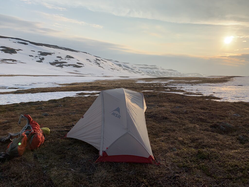
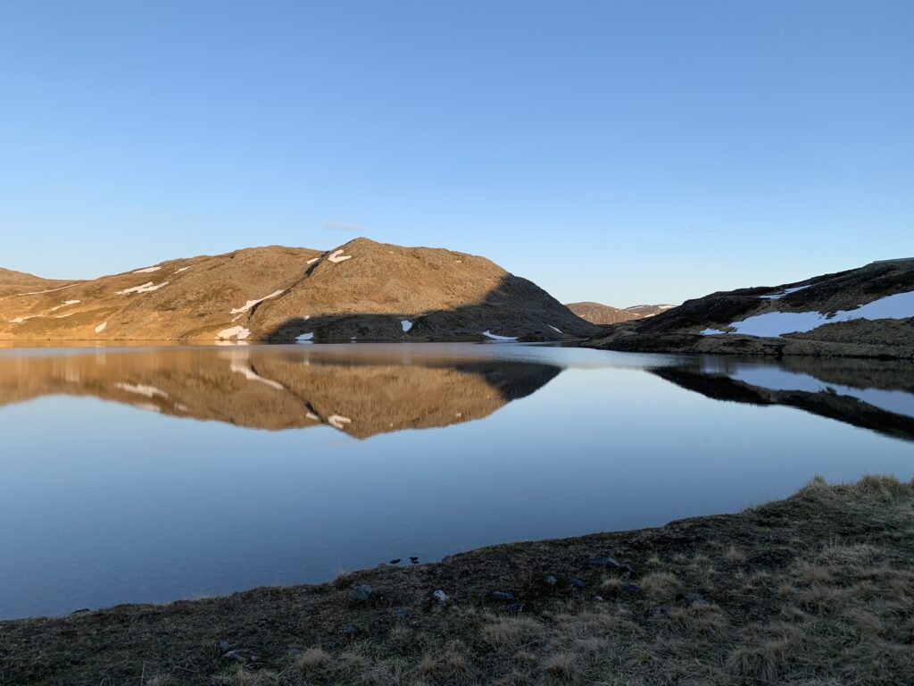
Just out of the North Cape tunnel, I started the 70 km crossing of the Porsanger peninsula by underestimating two relatively small rivers in a row by as much as 50 cm, resulting in soaked boots. The clear water is treacherous and always deeper than you think. However, already here around midnight on day three, I camped at what turned to be one of the most stunning spots of the entire trip: Fisketindvatnet (Roggejávri), image on top of this post.
Lafjordelva
The biggest river of the Porsanger section is Lafjordelva. Crossing at the mouth of the delta, as opposed to higher up where the markings are, was uncomplicated, though cold. Normally, facing bigger rivers like this, I keep the boots on, remove the soles and socks, then cross. My light hiking sandals are quite simply not stable enough on slippery rocks. But it does take several days for the boots to dry. The weather is so rough in this area that trail markers are often eroded away, especially along the deserted shore of the Barents Sea, where I stumbled over incredible numbers of debris washed onshore, including something I briefly suspected was a hand grenade but probably was some kind of anchor.
Lonely house by the Barents Sea
Reindeer fences pop up randomly, quite often blocking the trail requiring hikers to either squeeze under or crawl over the fences, or walk beside it looking for a broken section, which is not at all uncommon. Further down south, pedestrian passages have been made through the fences, but I did not see much of that in Finnmark.
River to be crossed with reindeer fence in the middle
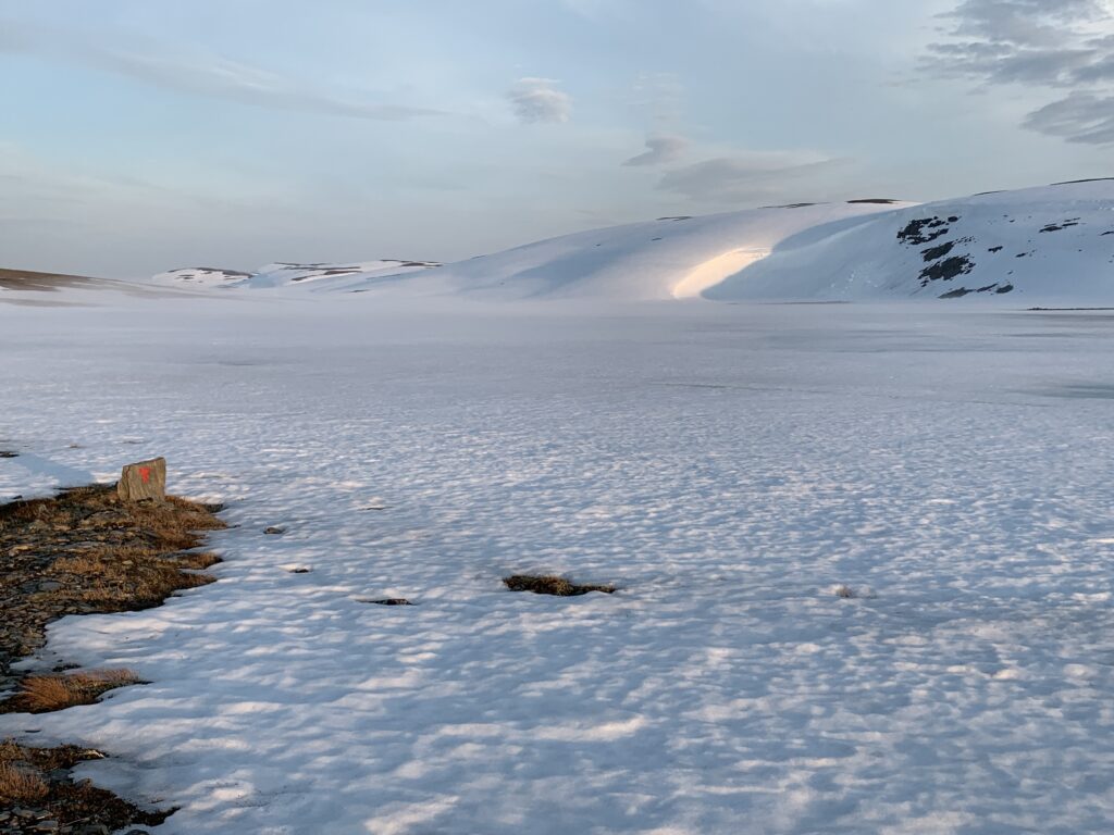
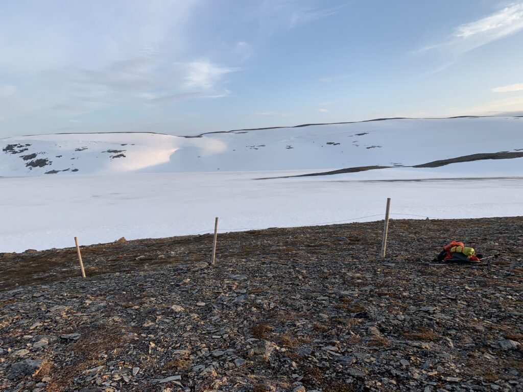
Before leaving, I had identified the area around Gárdevárri, central on the Porsanger peninsula, as the only one in Finnmark still with snow on the trail. Immediately before losing phone connection I re-checked the situation on senorge.no: Still between 25-50 cm snow for 15-20 km of the trail. Unsure what to make of that, I continued. Less than 50 people cross this peninsula every year, and I definitely wanted to be one of these. Most of this section follows a reindeer fence and route finding is thus not a problem. However once I reached the rotten spring snow walking was quite simply exhausting and I walked for hours not advancing more than 1 km/h.
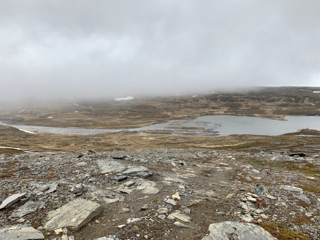
The area aound Gárdevárri
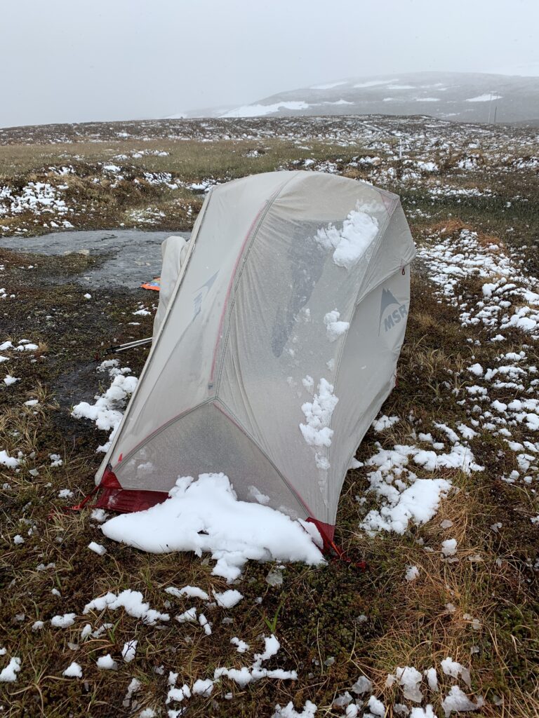
Finally, at 3 am in the morning, having struggled through rotten snow since early evening I finally fell through a snow bridge into an (admittedly small) river. I had enough and camped right there on the slope. Where I ended up spending the following day in the tent due to bad weather, listening to podcasts.
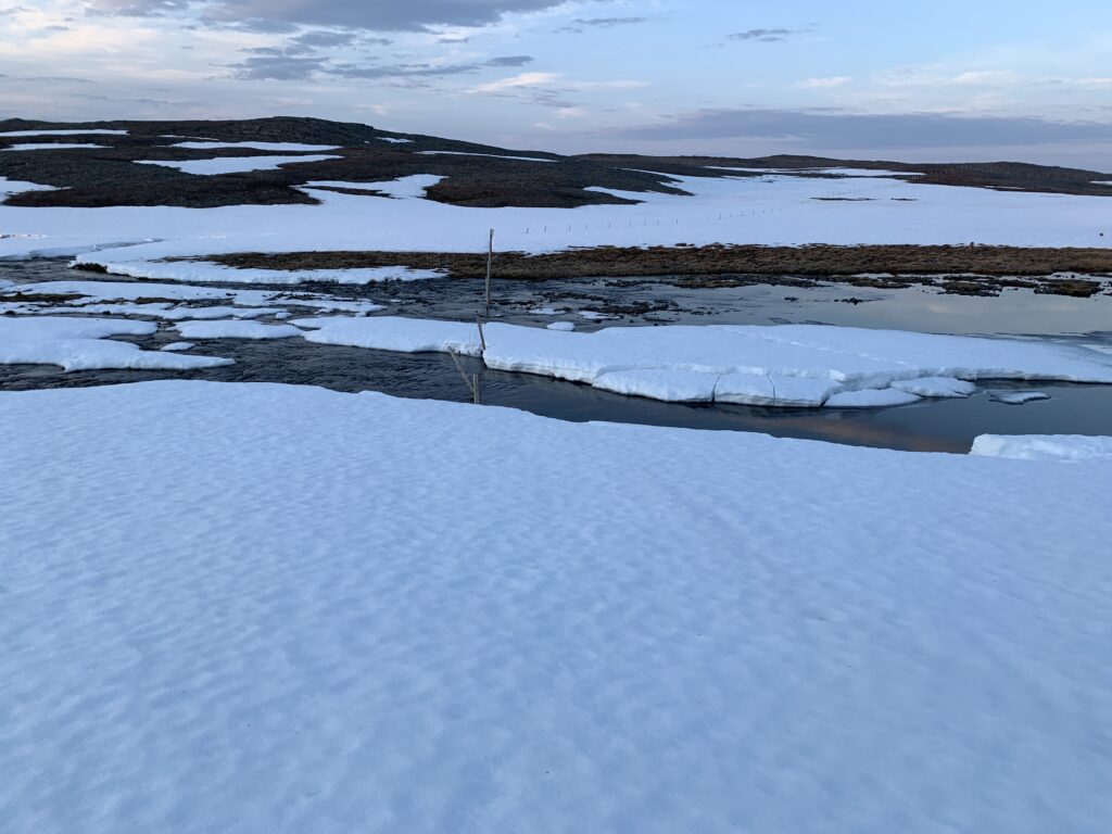
3 am: Came down from the snowy hills on the left.
Some may think that the worst weather to walk in is when temperatures drop far below zero. It is not. The worst type of weather is a windy mix of rain and snow with temperatures around zero. Statistics support that the number of fatalities in the Norwegian mountains is indeed highest in exactly this kind of weather. No matter the quality of your gear, it is impossible to avoid getting drenched and freezing cold. Combine that with constantly sinking into thigh-deep rotten snow and you end up with one of the two toughest days of the entire trip (the other one being down in Suldalsheiene).
Just crawled under a reindeer fence
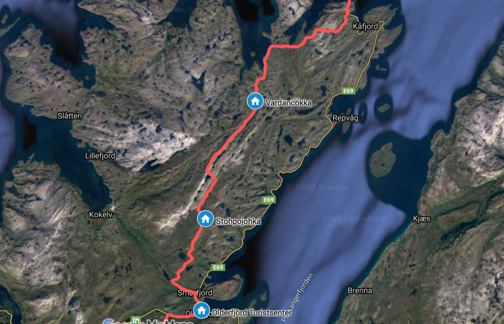
Trying to optimize the route, as opposed to following the DNT markers, I was completely drenched when I finally arrived at the open Stohpojohka cabin. Had there been firewood here, I definitely would have stayed. Especially since I had internet connection for the first time in several days. Many essential things to check: Most importantly, the weather forecast. And the availability at the Olderfjord hotel. Instead I got stuck with the official news of the signing of Eden Hazard to Real Madrid and completely forgot about the weather until the connection disappeared. Fortunately, from Stohpojohka, there were only a relatively short distance left through the snow. But completely drenched I walked down to Olderfjord Turistsenter to dry up before heading out on Finnmarksvidda.
Some of the lessons learned until now: #1: Never give up on situation (hiking route, river crossing etc) in prognostic borderline conditions or based on hear-say: Always evaluate the situation yourself before making major route decisions. #2: Know that you tend to underestimate water depth when the water is crystal clear. #3: Always start by checking the weather after an extended period of offline time. You never know when you´ll lose the connection. #4: The mix of rain and snow around zero degrees is the worst weather possible. Do not wear a down jacket in this type of weather, not even under a shell jacket, it will get completely soaked. #5: While snowfields in late summer are fine and hard, the spring snow is rotten and a nightmare to walk in. #6: Crocs or even light sandals are not for river crossings. I knew that before, but it was reconfirmed here.
June 2nd 11:55 am: The bus driver dropped me off at Knivskjellodden Parking, 7 km before The North Cape plateau. From here it is a 9 km walk out to Knivskjellodden, the northernmost point on Magerøya, ~1,5 km north of The North Cape. Would it be too risky to hide the backpack at the parking while making the return trip out there? I decided to take the chance. Magerøya is far from flat and the return trip to Knivskjellodden includes a 500 m descent/ascent.
Knivskjellodden
Only a few other people were out at Knivskjellodden, but there was no trace of the Norge på Langs book, where people have been known to sign in to officially mark the beginning of the, in my case, 2686 km long hike to Lindesnes Fyr. On the straightforward trail to get there, you most notably pass Knivskjelvatna, the northernmost fishing lake in Norway, though the people I met fishing failed to catch any fish there. Though I didn´t realize it at the time, I later found out that the two girls with a dog and a Norwegian flag crossing me on the trail were Fjolls Te Fjells, also just starting Norge på Langs.
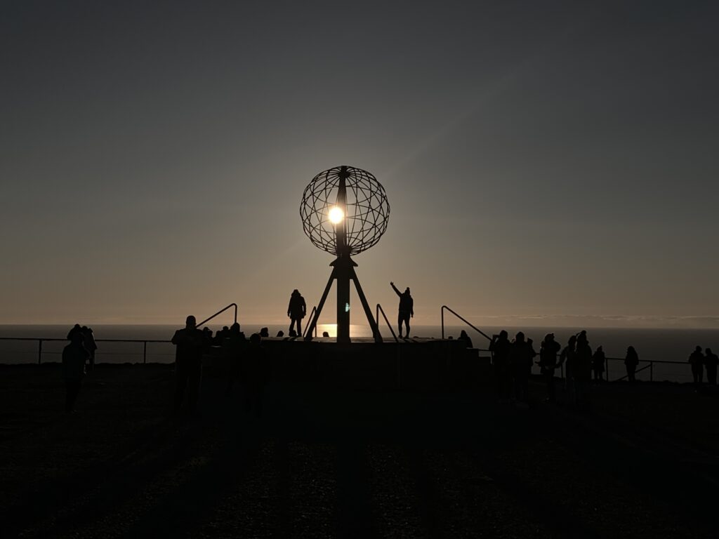
Normally asked where I started to walk, I say The North Cape, to avoid a lengthy explanation of where the rather unknown Knivskjellodden exactly is. However, once back at the Knivskjellodden parking I did actually decide on the 14 km return walk out there,, though technically not part of the trip. However The North Cape plateau is a weird, fascinating place, complete with a Thai Museum, and a quite good restaurant/café in addition to a parking lot packed with campervans. I was there just before midnight, unsurprisingly a popular time to visit with plenty of tourist buses on the road.
Crossing Magerøya
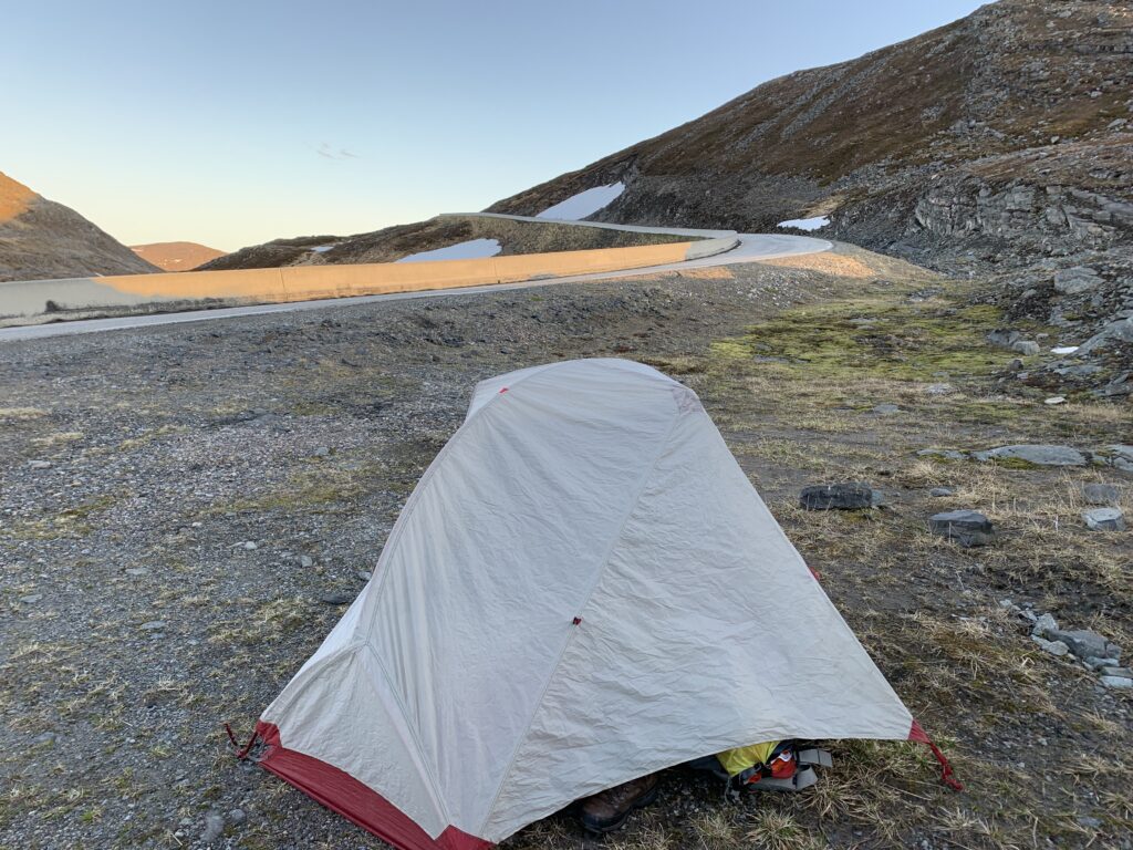
I am not sure where the saying “Either you suffer before the trip or on the trip” comes from.But, due to my habitual lack of predeparture training I have by now gotten used to suffer in the beginning of a long hike. This first day I walked 33 km. which, all things considered, was far too much. And despite my wellworn boots, I started out with two blisters, though small. At 3 am I was so exhausted that I ended up pitching my tent right by the road just opposite Kjeftavatnet, on what turned out to be the worst camping spot of the entire trip. In addition, construction workers arrived to work at the tent site the following morning.
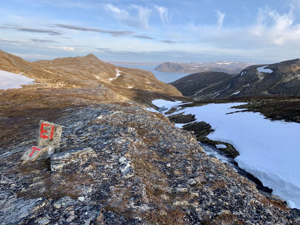
The North Cape plateau is where the E1 long-distance hiking route begins. Generally the E1 was not easy to find on Magerøya, but it runs very close to and parallel with the paved road, the markers hidden under the last meter of melting snow. I had studied senorge.no intensively up until the departure to verify that snowmelt was completed on Magerøya, which it indeed almost was. When I finally had to leave the road on the second day and cross down to the tunnel, it turned out to be far less difficult than expected to navigate through the snow.
Heading straight down to the ocean and then right for the North Cape Tunnel
The timing of the trip was close to perfect: Spring had just arrived. Snowmelt was in the last stage, though not yet completed. The grouse had laid their eggs in nests on the ground. The midnight sun was approaching maximum. I spotted numerous reindeer calves close to their mothers in the huge reindeer herds, that are found everywhere here on Magerøya: 5000 reindeer spend the summer here, I was told.
Kjeftavatnet
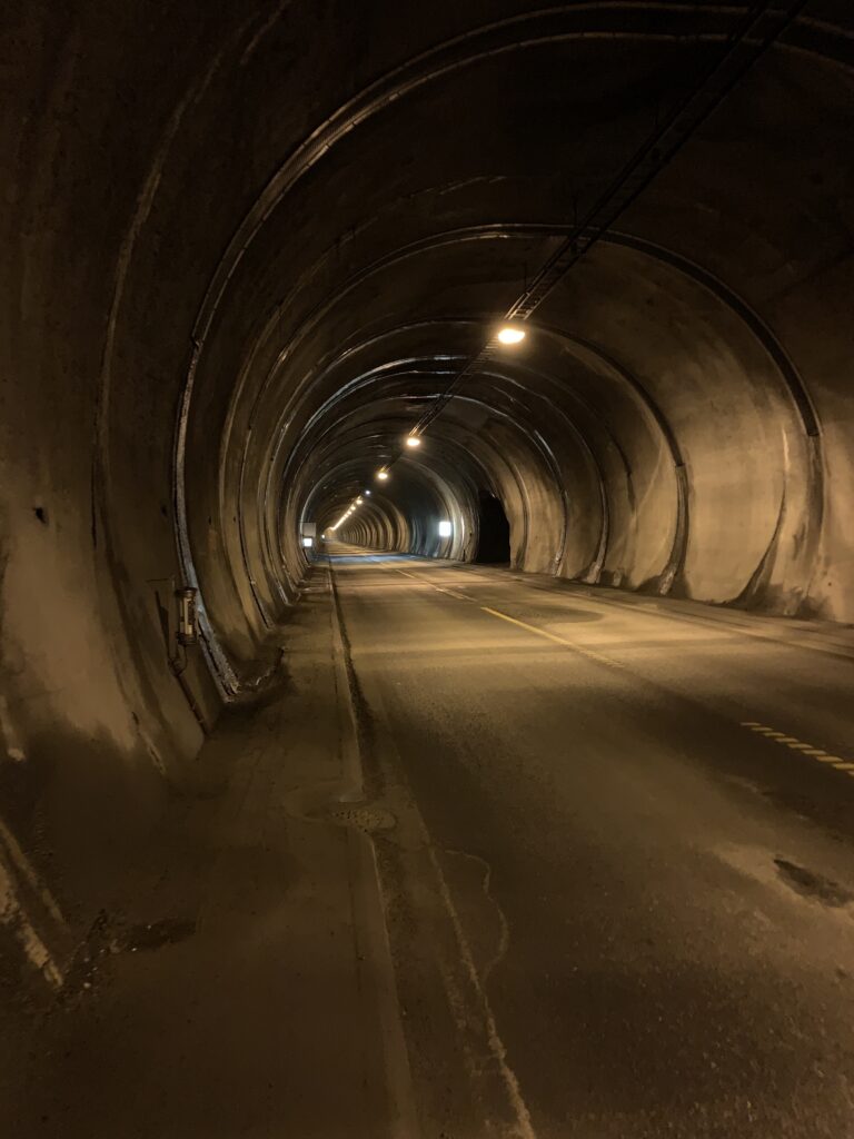
I am surprisingly often asked about the walk through The North Cape Tunnel: It was 7 completely eventless and uncomplicated kilometers with ample space for pedestrians on both sides. There is however, too much noise in the tunnel to listen to podcasts, but that´s about it. Built in 1999, I well remember taking the ferry when I first visited The North Cape in the mid-80s, where in addition our family car broke down just before the ferry and we stayed overnight at the car mechanic´s private house in Honningsvåg. This kind of hospitality from complete strangers is far from rare off the beaten track in Norway, something I later experienced on this trip as well.
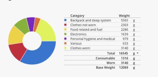
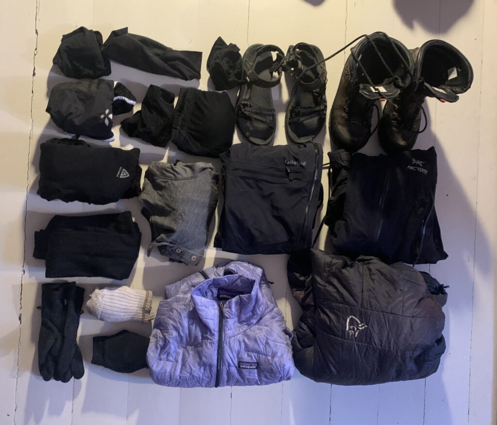
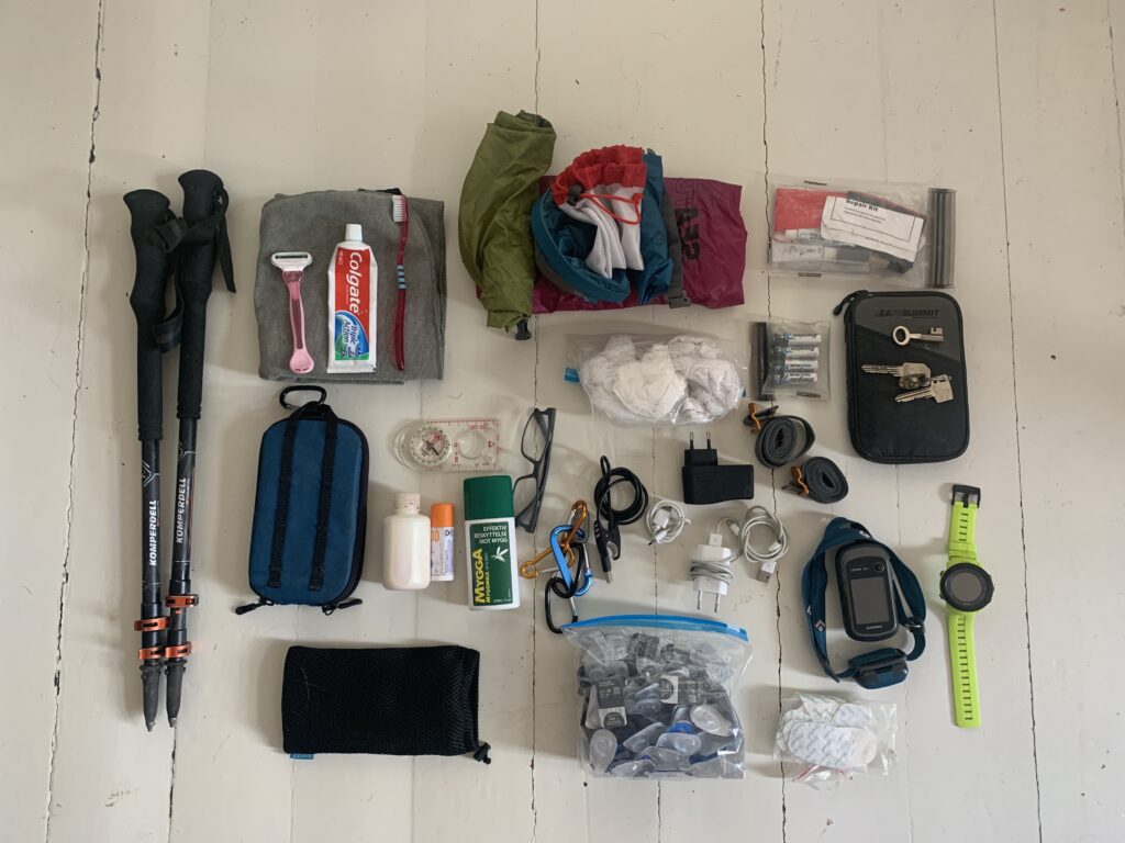
Click on the picture for the full packlist via lighterpack.com. The above list includes food for 4 days.
Frankly speaking, most gear set-ups will probably work for most walking Norge på Langs, and the only important recommendation I will put forward is to use well-tested equipment and bring repair kits for basic repairs.
While I do not belong in the ultra-light hiking category, I am nevertheless quite conscious of weight: Base weight (without food) should not exceed 11-12 kg, and I do not intend to carry more than 20 kg at any point including the 12-day food carrying stretches. Thus, as I do not resupply, the main challenge was to bring equipment sufficient for the duration of the trip, covering a temperature span of >30°C, while keeping the weight reasonably down at the same time. Whether you walk for one week or three months, your basic gear requirements are essentially the same.
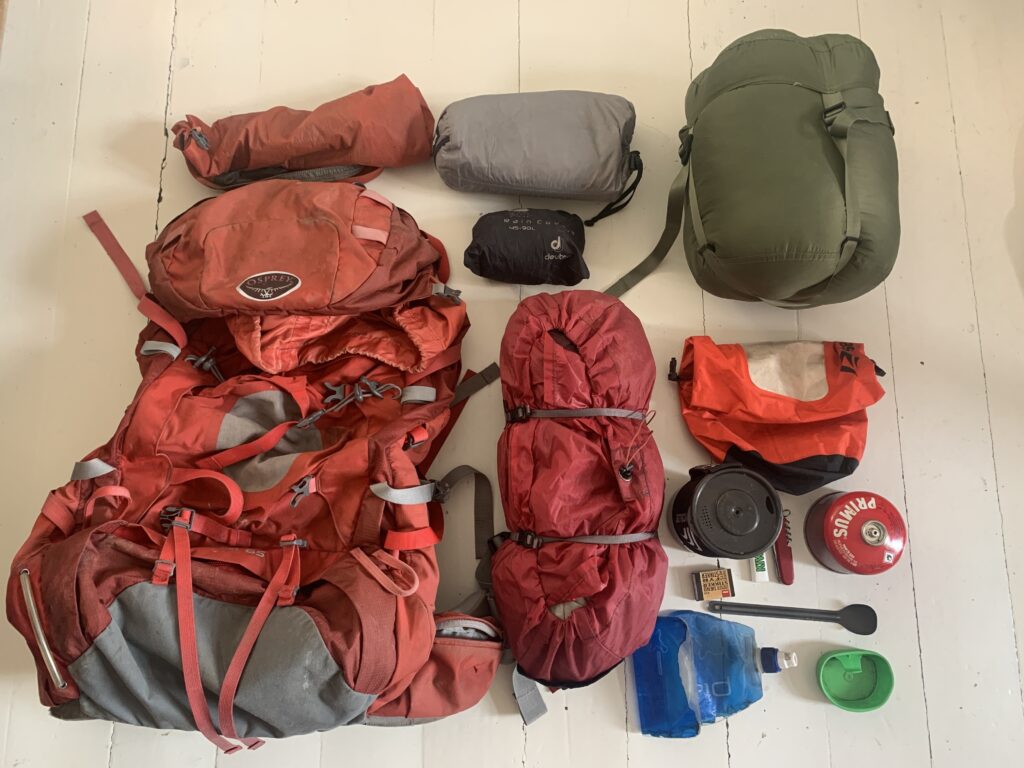
Backpack:Osprey Ariel AG 65 L: 5 years old. With the tent strapped on the outside together with the main food bag (for the long unsupported stretches), 65 L was enough space. I had no issues at all with this backpack.
Sleeping bag:Warmpeace Viking 900: 6 years old. Comfort temp: -7 °C. While I did not encounter temperatures below -3 °C, I spent many nights around zero. Tore a small hole in it in Ryfylkeheiene (repaired with a patch). I never had a cold moment in this sleeping bag. Helsport Compression Bag M: Had to buy this new compression bag in Alta as the one I initially brought (from Sea To Summit) broke down. Furthermore I used an ordinary plastic bag, to ensure the sleeping bag never was wet.
Sleeping pad:Thermarest NeoAir X Therm Regular: 6 years old. Worked perfectly throughout the entire trip. Never had a hole in it despite the quite rough use.
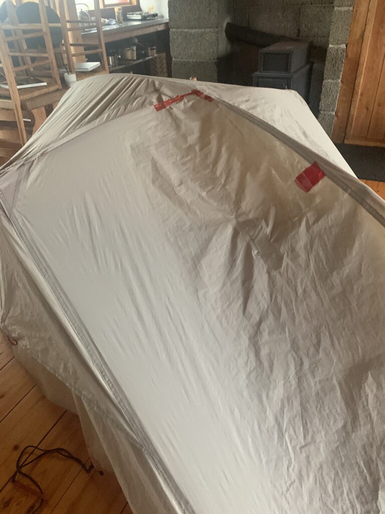
Rift in tent cover repaired with glued-on plastic bag in the Krossvatn Hut in Ryfylkeheiene.
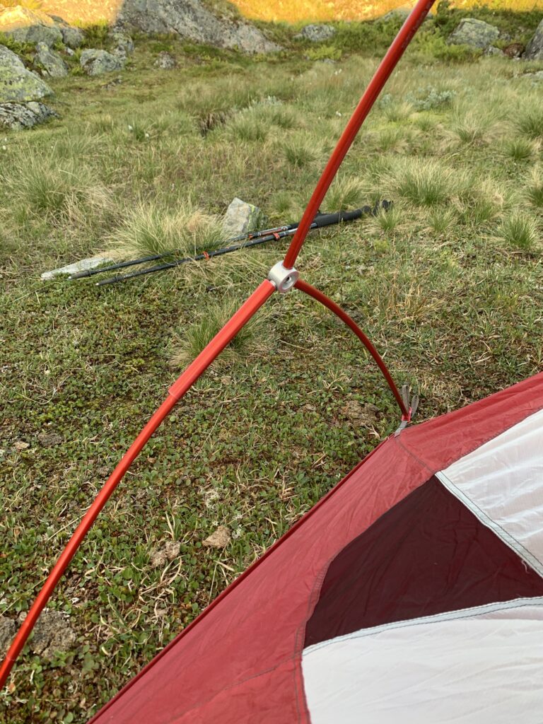
Tent:MSR Hubba NX 1- person. 6 years old. A 3-season tent, especially susceptible to side winds. I would not trust it to handle more than 12 m/s wind. Objectively I don´t think this tent is adequate for the long wilderness stretches I´d have to pass (such as Finnmarksvidda), but after lifting my backpack in Abisko parking lot (including my 2,2 kg Hilleberg Soulo 4-season tent) I took a calculated risk and went for this 1,3 kg tent. It went well, but I would not recommend saving weight on something as essential as the tent. The tent is 6 years old and used a lot as I like the very spacious design. I had no tent issues in the North. However, in the South a pole broke on the second day while setting the tent up peacefully in a forest just outside Trondheim (temporarily fixed with replacement tube). Later on, the storm in Ryfylkeheiene led to a large 2* 40 cm tear in the outer tent, repaired with a piece of glued-on plastic trash bag. When camping in wet and rainy conditions, as I did in Jotunheimen, the outer tent remained dry, but water leaked into the tent from the bottom. I did not use a footprint.
Tent pole with temporary repair with the spare pole (don´t forget to bring these for long trips!)
Clothes: Two sets of clothes: One set for sleeping, one set for walking.
Clothes for walking: The Boots: From Kilpisjärvi I walked in the brand-new Alfa Bever Pro Advance GTX boots I had to go off-trail and buy in Tromsø, as my 3-year old Meindl boots broke irreversibly in Reisadalen, probably after being exposed to too much heat in a small log cabin. Weighing 895 gr per boot, th boots, marketed as hunting boots, are far from light, but they were perfect for the conditions and so high that the vast majority of rivers could be crossed keeping them on.
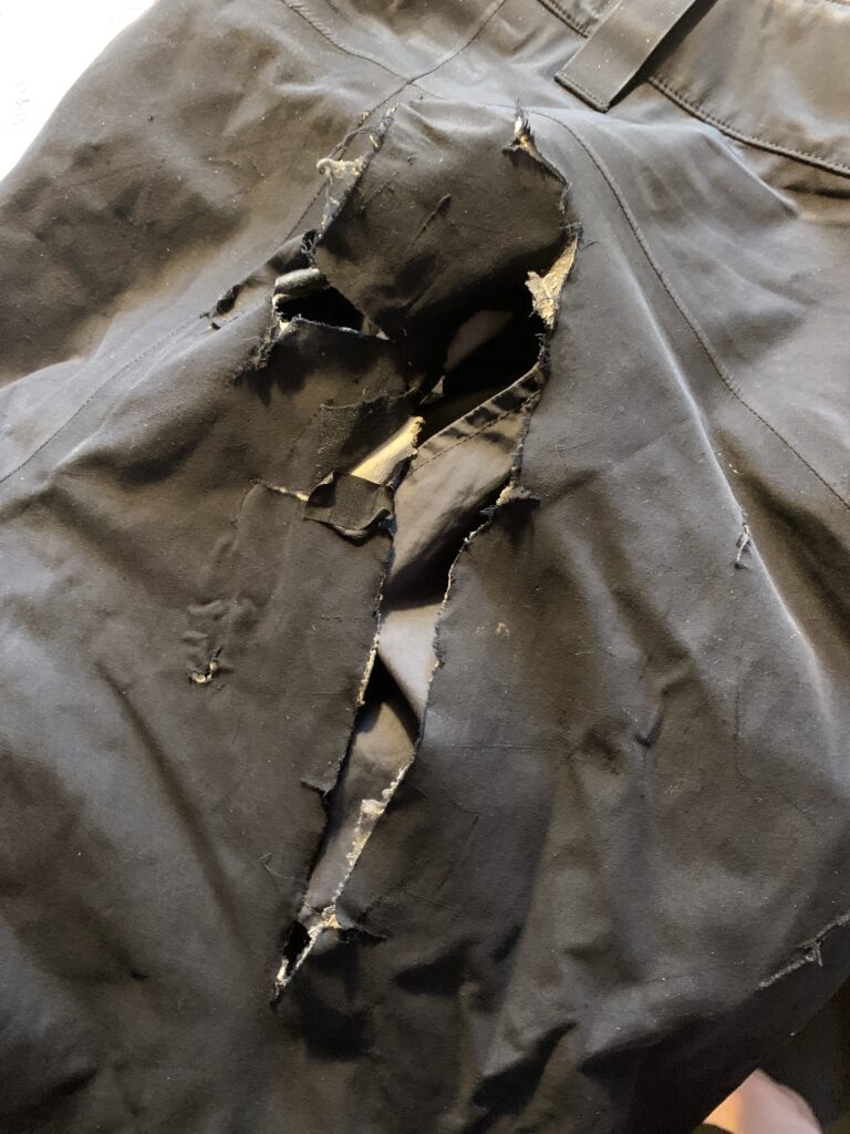
The pants:Norrøna Falketind Gore Tex pants are marketed as breathable, all-round Gore-Tex pants. They work best below 10 °C and are probably not breathable enough for this kind of nordic summer hiking trip, despite leg-long zippers. I found them comfortable and, in fact, ended up buying two pairs: The first were ruined with a large tear on the buttock crawling on a suspect bridge near Cunojávri, the second pair were ruined by an even larger tear sliding down a snow field as well as a scree slope in Kyrkjesteinsdalen. Thus, in my opinion, the pants are not worth the money for this kind of trip, especially since Norrøna charged half the price of a new pair to repair them afterwards. Thus I ended up losing almost 1000 US dollars for two brand-new pants, which both broke during the trip. In hindsight, I should probably have brought my Fjällräven hiking pants, but I thought the Norrøna pants would be more allround, especially in rainy and snowy conditions.
The tear in the Norrøna Falketind pants after sliding down a snow slope as well as a scree slope in Kyrkjesteinsdalen, Suldalsheiene.
Upper body 3rd layer: Arcteryx Alpha SV shell jacket. 6 years old. Not as waterproof as it has been, however a great jacket that I have used 100 of times, well worth the (quite high) price.
Norrøna Trollveggen down jacket. 4 years old. A genuine winter jacket. Wore it when temperatures were around zero °C . The right zipper broke during the trip, which Norrøna repaired free of charge. To carry the extra 660 gr was one of the best gear decisions I made.
Socks: Two pair of wool socks (one for hiking, one for sleeping). Underwear: 1 bra, 2 underpants. All 100% merino wool. Warmpeace Skip Hat Buff merino wool tubular Norheim fleece gloves: Bought in 2020 during the trip (Åndalsnes) as temperatures began to drop below zero. Essential for autumn hiking.
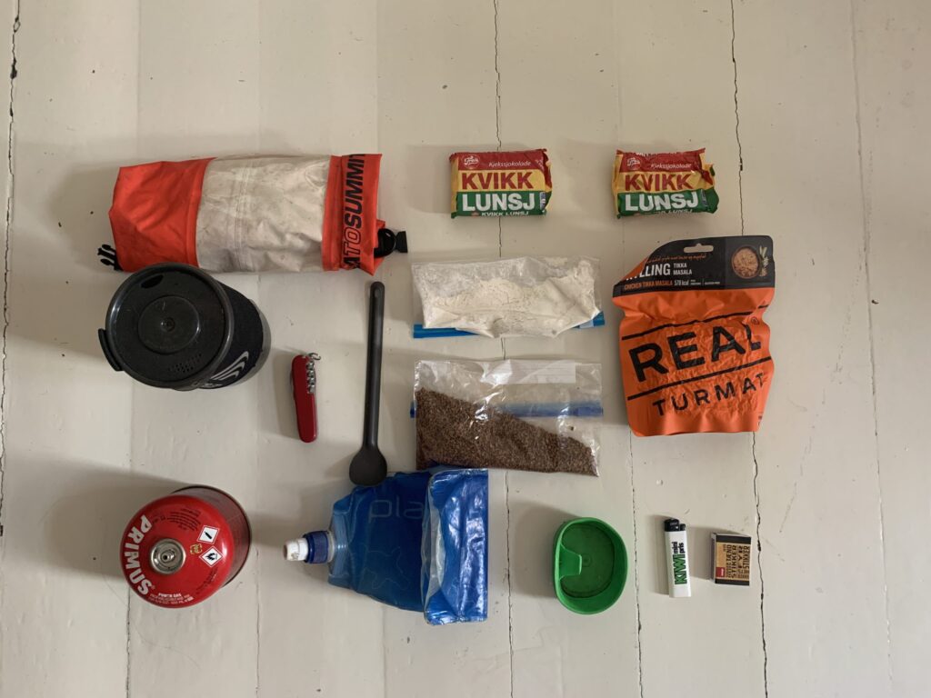
Food items: ~200 gr. Nescafé coffee powder ~100 gr. CoffeeMate (as milk powder seems to clump and I only use it in my coffee)
”Minimum food” is the food I carry per day, when carrying food for > 7 days: 2 Kvikk Lunsj chocolate bars (morning + lunch, 249+249 kcal), 1 Real Turmat, or other brand (evening,~600 kcal). In addition I carry the coffee powder and milk powder as per above. In addition, I´ll eat whatever I find in huts etc. Thus ~1100 kcal per day, and far less than the 5-6000 kcal I spend on an average day. But for 10 days it is fine, and most importantly, it keeps the weight down. Freeze-dried food is the most economic in terms of weight/calorie ratio. If I cannot get it, I´ll eat pasta or noodles for dinner. Generally I have to chose items with short cooking time, as the resupply points for gas are more rare than for food items. South of Børgefjell, resupply possibilities were plenty and I´d carry quite a lot more food per day, adding bread, sausages, cheese to the “minimum food“.
Toiletries: 1 mesh bag (3L): Tooth brush, tooth paste, toilet paper, lightweight towel. 2 drybags (4L +1L): Compeed, contact lenses, Ibubrufen, small multi-knife, lady shaver.
Electronics: Anker Powercore+26000 (2020): The most powerful powerbank I could find. Well worth the weight of 590 gr. Charges my iPhone about 10 times and was essential (podcast, photo etc.) during my 12 days stretch without power supplies in Ryfylkeheiene. SolarMonkey Adventurer solar Panel (2019): Worked well, helped by the midnight sun. Generated sufficient energy to enable my iPhone to be in constant GPS mode for 10 days, including podcast listening etc. Garmin eTrex 30x GPS (only incoming signal). iPhone XR (including cable): Probably the most essential item on the trip. Used as GPS, camera, podcast-listening, book reader. Suunto Ambit3 sports watch. Various charging cables as per above (*2 for iPhone)
Various
DNT key Compass Head lamp Spare batteries Mini carabiner (6-7 pieces) Straps (*2) Sunscreen Mosquito spray Reading glasses Repair kit for sleeping pad, tent, extra goretech patches. Wallet with private items: Passport, keys, credit cards etc.
Komperdell adjustable hiking poles Used mainly for balance during river crossings, but also in general. However, no matter how tight I made the locking syste, they would occasionally tend to be shortened when put under pressure in some semi-critical moments, which made me not quite trust them. In 2019 I used Distance FLZ trekking poles, however the closing system did not always work smoothly.
Fishing equipment: Only in 2019. Most days I was too exhausted to fish, and when I was not, I didn´t catch anything. A point to improve on.
What I did not bring:
First-aid items apart from mentioned below. Because I do not think they are necessary. Sunglasses. Because I never use them. Water: I never carried water. There was always plenty to find on the way.
GPS emergency sender: Quite frankly I did and do not find it necessary for this sort of trip. I am after all not crossing the North Pole. The thought that I have to manage whatever happens is actually quite liberating. Furthermore, in my opinion the biggest objective danger is river crossings, where an emergency spot would not help.
Paper maps: Carrying all the maps for the entire trip would first of all have been quite heavy, and secondly, quite expensive. But I was slightly anxious about this choice at first. I did have an old map covering half of Finnmarksvidda and two-thirds of the Narvik mountains, but after that I went 100% electronic.
Plan for navigation: Plan A : Use the GPS on my iPhone (norgeskart and the ut.no app both work offline). Plan B: If plan A fails, I have a Garmin GPS with routes downloaded whenever I could find them for free. Plan A never failed though and I never needed my GPS. Plan C: I brought a compass for potential emergency exiting an area (such as Finnmarksvidda). My compass never left my backpack.